How it's made
From public data to a thing on a desk
No part of a plate is drawn by hand — every line comes from measured data. That is a constraint rather than a shortcut: it is why what a child learns from one of these is true, and it is also why each new place takes real work to get right.
- 01
Choose the cut
A region and a way of dividing it: cantons, countries, districts, or — for the watershed series — sub-basins, where every boundary is a ridge line. The division decides what the puzzle teaches, so it is chosen before anything else.
- 02
Clean the boundaries
Public boundary data is messy: slivers, gaps, duplicated coastline, enclaves too small to print. Boundaries are snapped and simplified to a tolerance that keeps a shape recognisable while removing detail no printer could resolve. Pieces below the minimum size get merged into a neighbour rather than shipped as something a child would lose.
- 03
Sample the terrain
Elevation comes from public digital elevation models, resampled onto the plate and vertically exaggerated by a factor chosen per puzzle — enough that the relief is readable at desk size, never so much that the landscape becomes a caricature. The factor is printed on every puzzle page.
- 04
Lay the water and the snow
Rivers and lakes come from hydrological datasets and are printed as a blue shell over the green land surface. Snow is snow-persistence data — where snow actually lies — rather than a height threshold, which is why the white on the Alps looks nothing like the white on the Rockies.
- 05
Cut it so it works
Every piece is checked: watertight, above the minimum area, with the clearance a printer needs to release it. Long thin features have a floor too — a road thinner than about half a millimetre simply slices away and would print as nothing at all, so it is either drawn thick enough to exist or not drawn.
- 06
Print it in one go
Printed in PLA in Switzerland, in place: the pieces come out of the printer already inside the frame, seated and separable. Nothing is glued, assembled or hand-finished, which is why a replacement piece is a reprint rather than a repair.
Four colours, and only four
The printer loads green, blue, white and red. Everything you see on a plate is one of those four doing a specific job, which is also why this website is that colour.
- Green
- The land surface. One solid piece from the base to the top of the terrain — the relief is the shape of this, not a texture on it.
- Blue
- Rivers, lakes and sea, printed as a shell over the land. On watershed plates the main stem is carved in, so the river is below the surface rather than on it.
- White
- Snow, where snow persists. It is the only colour on a plate that changes with the season it represents rather than with the ground.
- Red
- The body under everything else. You only see it at a cut — which means the red lines on a plate are exactly where it comes apart.
Scale is a choice
The same plate size holds the whole planet or a single valley, and the difference between them is three orders of magnitude. On The World, one millimetre is about 157 kilometres. On the Swannanoa it is about 163 metres — roughly the length of a running track.
Vertical exaggeration is set per puzzle to match. At continental scale, real height would make the Himalaya a barely perceptible ripple, so it is stretched. In a steep Appalachian valley the opposite is true and true height would not fit on the plate, so it is compressed. Every puzzle page states the factor used, because a relief map that hides its exaggeration is lying about the ground.
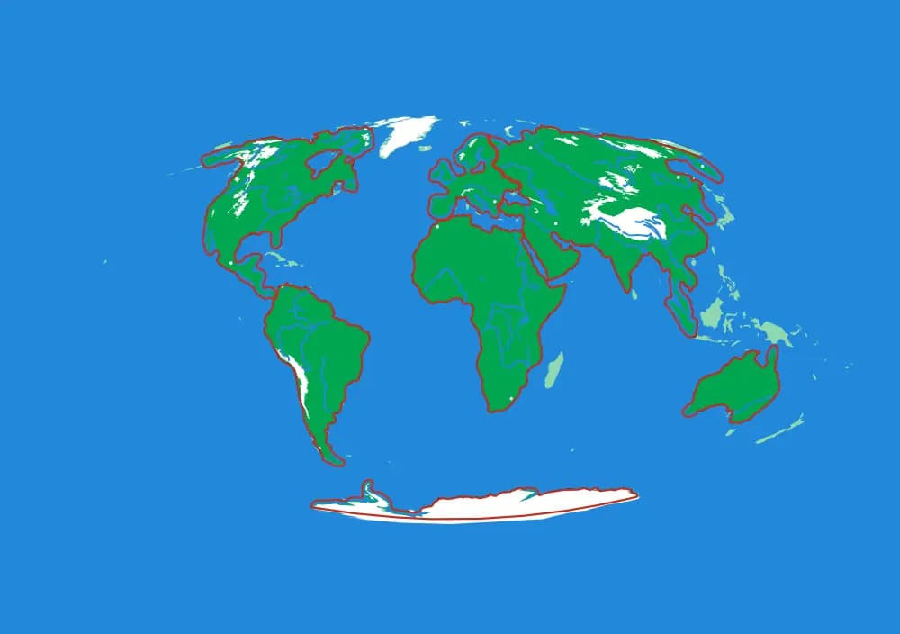
The World — 1 mm ≈ 157 km
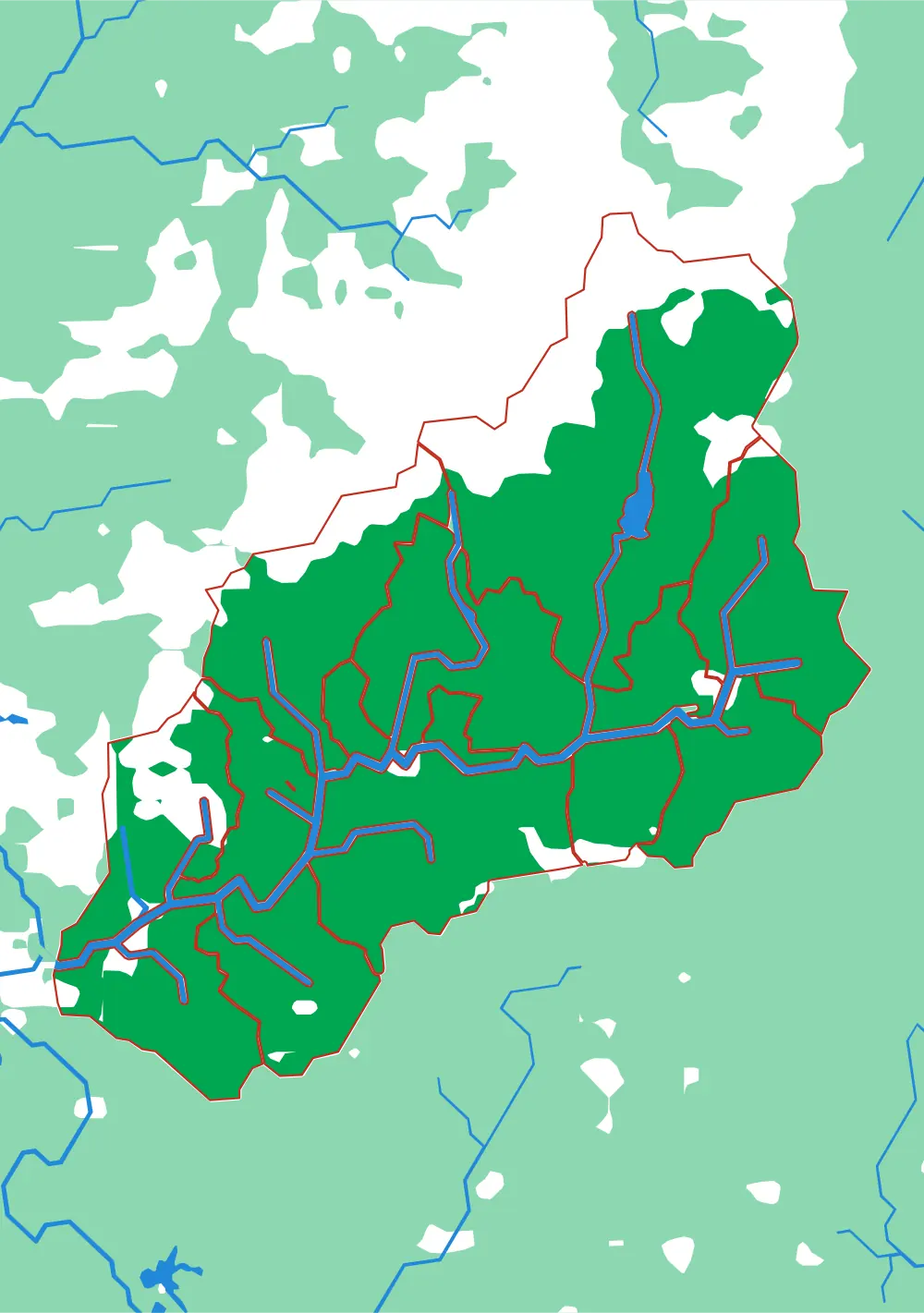
The Swannanoa — 1 mm ≈ 163 m
The pictures on this site
Every plate shown here is drawn from the same geometry file the printer is handed — the actual cut lines, the actual water, the actual snow, in the actual four colours. It is generated, not illustrated, so it cannot drift away from the object it advertises.
What it honestly cannot show is the relief, because it is a view from directly overhead. Photographs of the printed plates are the missing piece and they are coming; until they exist, this seemed better than a stock photograph of somebody else’s puzzle.
Somewhere else in mind?
A new region is not a drawing job, but it is not a button either: the work is choosing what the pieces should be, finding data honest enough to cut from, and tuning the simplification and the relief until the plate both prints and reads.