The collection
28 puzzles, 549 pieces
Each plate is B5 — the size of a school exercise book — and each piece is a real place at its real height. Grouped by what the cuts follow: continents, watersheds, borders, or the ground you can see from the window.
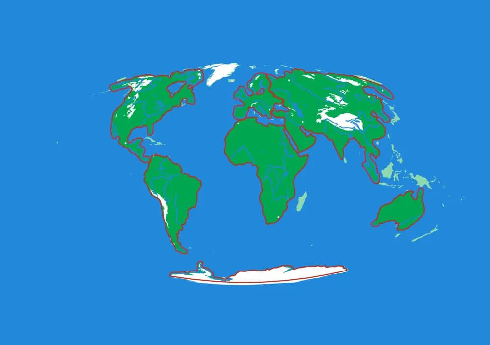
The World
Where every other puzzle sits.
One plate, seven continents, and the whole ocean around them. This is the map a child reaches for first and keeps coming back to, because every other puzzle in the collection is somewhere on it.
Watersheds
Maps of where the water goes.
A watershed is the most useful shape in geography and almost nobody is taught it: all the land whose rain ends up in the same river. These puzzles have no political borders at all. Every cut follows a ridge line, and every piece is one tributary's country. Assemble one and you have physically built a river system out of the land that feeds it.
North America by River
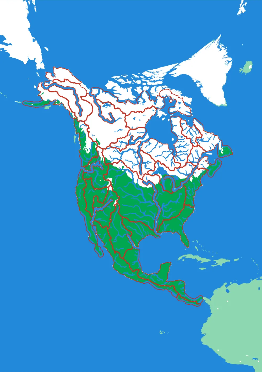
A continent divided only by where water goes
No countries, no states. Twenty-nine pieces, each one the whole territory that drains into a single river.
- Pieces
- 29 pieces
- Scale
- 1 mm ≈ 49.4 km
- Suitable for
- Ages 8 and up
- Price
- CHF 120.00
The Mississippi
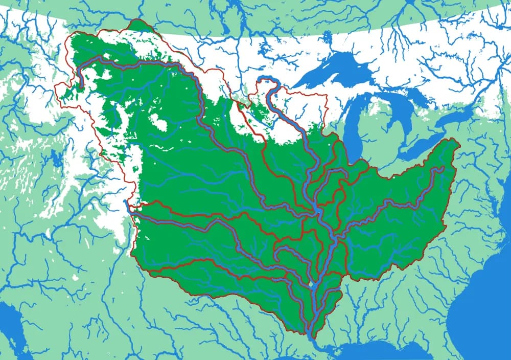
The basin that drains a third of a continent
Fifteen pieces — Missouri, Ohio, Arkansas, Red, Illinois — that together are about three million square kilometres of drainage.
- Pieces
- 15 pieces
- Scale
- 1 mm ≈ 14.5 km
- Suitable for
- Ages 8 and up
- Price
- CHF 120.00
The Ohio
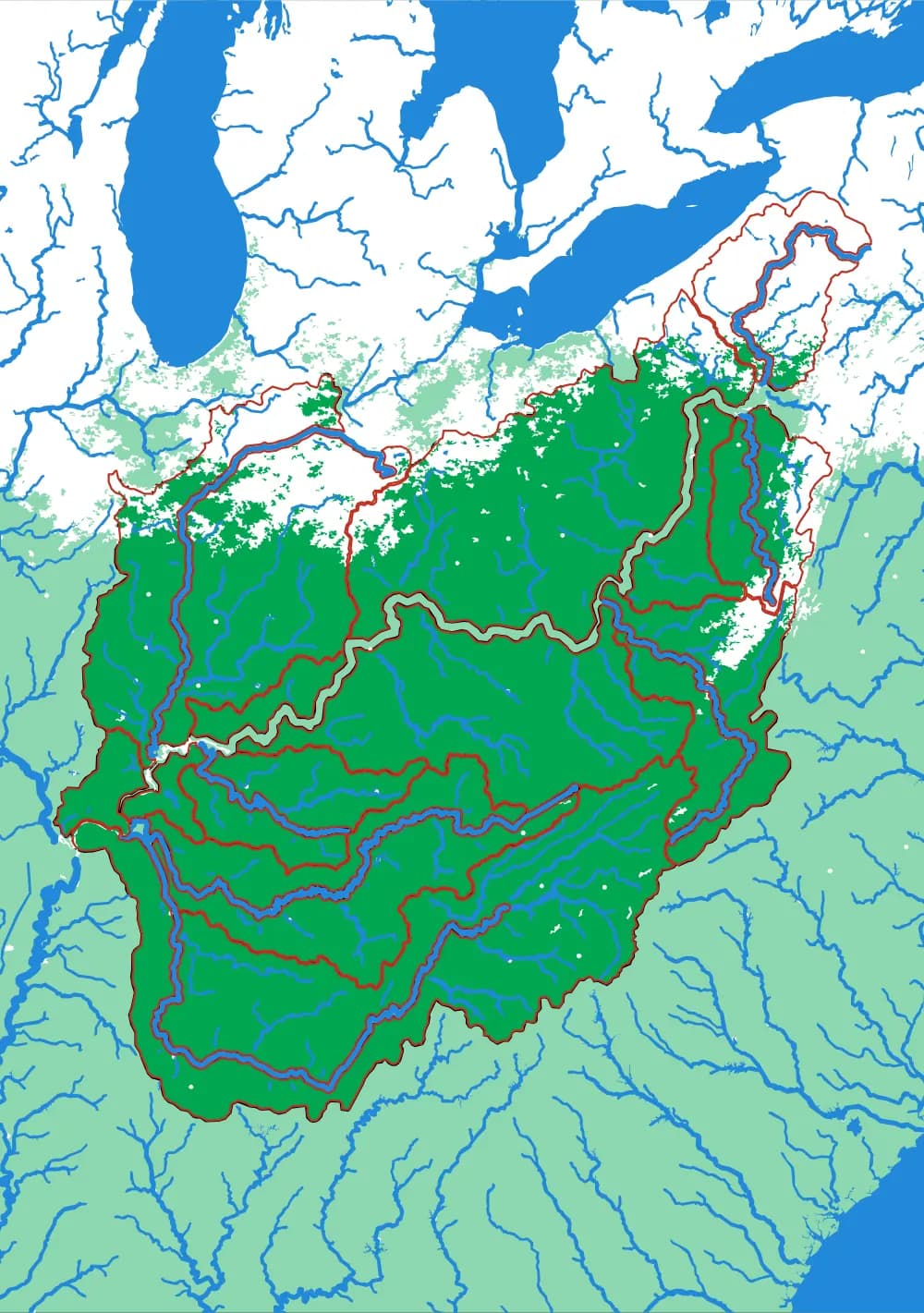
Where the Appalachians drain west
Eighteen pieces: the Tennessee, the Cumberland, the Allegheny, the Monongahela, the Wabash and the ridges between them.
- Pieces
- 18 pieces
- Scale
- 1 mm ≈ 5.8 km
- Suitable for
- Ages 8 and up
- Price
- CHF 120.00
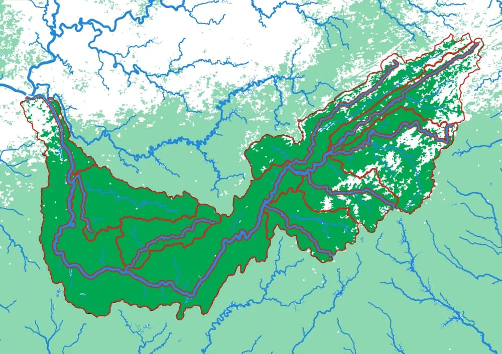
The Tennessee
The river that goes the wrong way
Seventeen pieces including the French Broad, the Holston, the Clinch, the Little Tennessee and the Hiwassee.
- Pieces
- 17 pieces
- Scale
- 1 mm ≈ 2.8 km
- Suitable for
- Ages 8 and up
- Price
- CHF 120.00
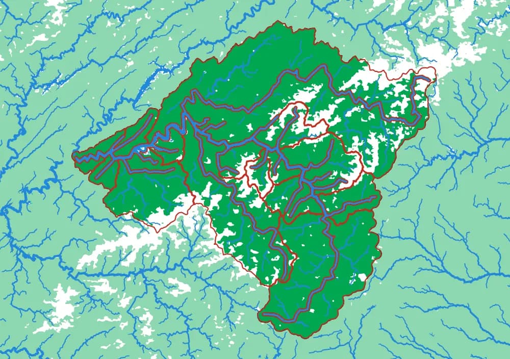
The French Broad
Older than the mountains it runs through
Seventeen pieces around Asheville — the Swannanoa, the Pigeon, the Nolichucky, Big Laurel, the Ivy.
- Pieces
- 17 pieces
- Scale
- 1 mm ≈ 976 m
- Suitable for
- Ages 8 and up
- Price
- CHF 120.00
In development
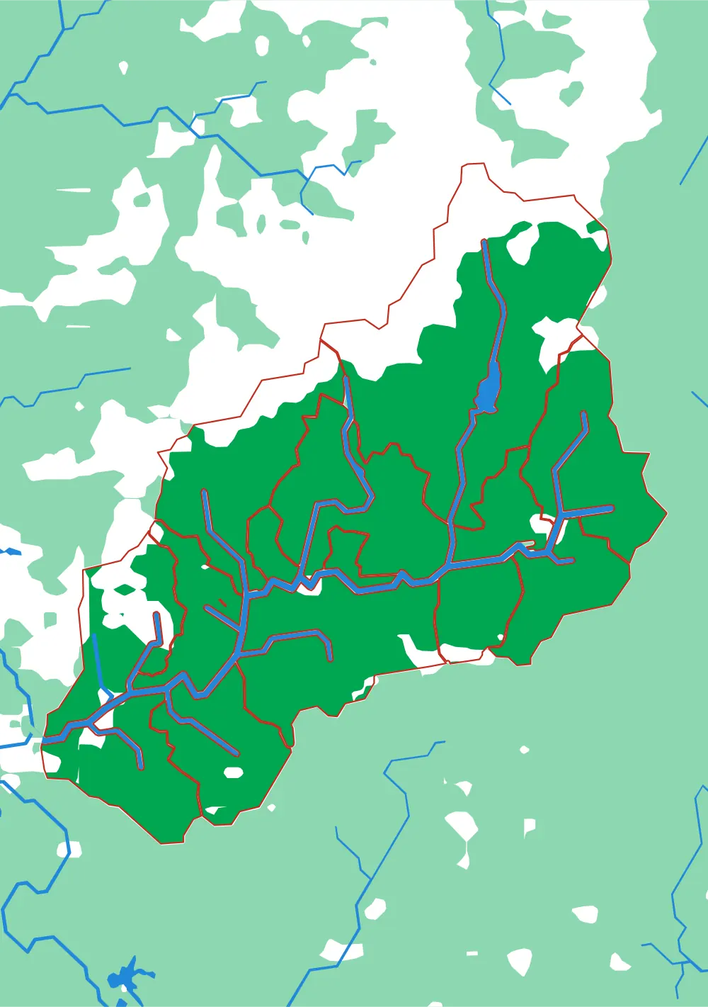
The Swannanoa
One valley, fifteen creeks
The deepest zoom in the collection: a single Appalachian valley, cut into the fifteen creek basins that make it.
- Pieces
- 15 pieces
- Scale
- 1 mm ≈ 163 m
- Suitable for
- Ages 9 and up
- Price
- CHF 120.00
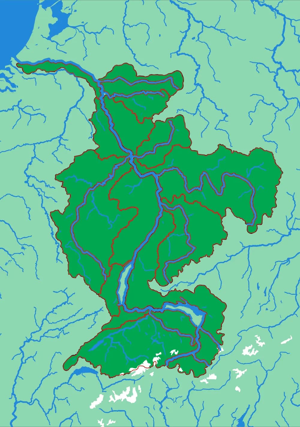
The Rhine
From the Alps to the North Sea
Twenty pieces — the Aare, the Main, the Neckar, the Mosel — crossing six countries without showing one of them.
- Pieces
- 20 pieces
- Scale
- 1 mm ≈ 3.4 km
- Suitable for
- Ages 8 and up
- Price
- CHF 120.00
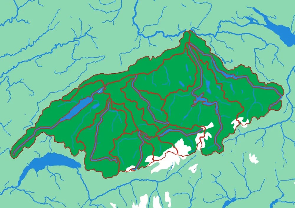
The Aare
Switzerland's own river, whole
Fifteen pieces — the Reuss, the Limmat, the Saane, the Zihl — covering most of the Swiss plateau.
- Pieces
- 15 pieces
- Scale
- 1 mm ≈ 1.1 km
- Suitable for
- Ages 7 and up
- Price
- CHF 120.00
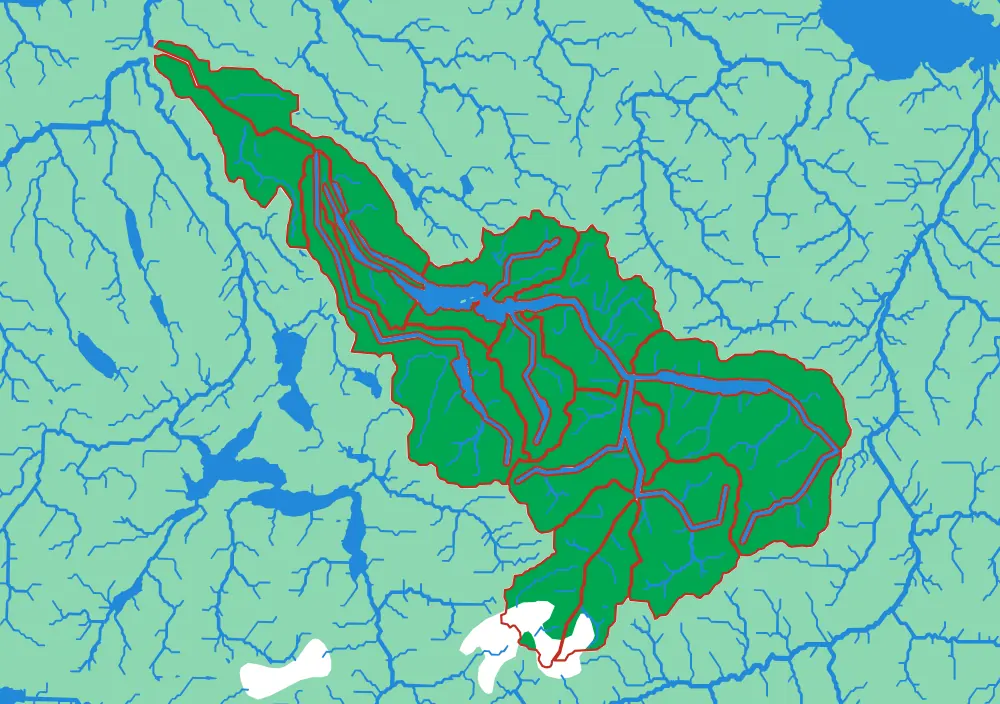
The Limmat
Zürich's water, from the Glarus Alps down
Fifteen pieces following the Linth and the Limmat from the high Alps through the lake and out past Zürich.
- Pieces
- 15 pieces
- Scale
- 1 mm ≈ 517 m
- Suitable for
- Ages 7 and up
- Price
- CHF 120.00
In development
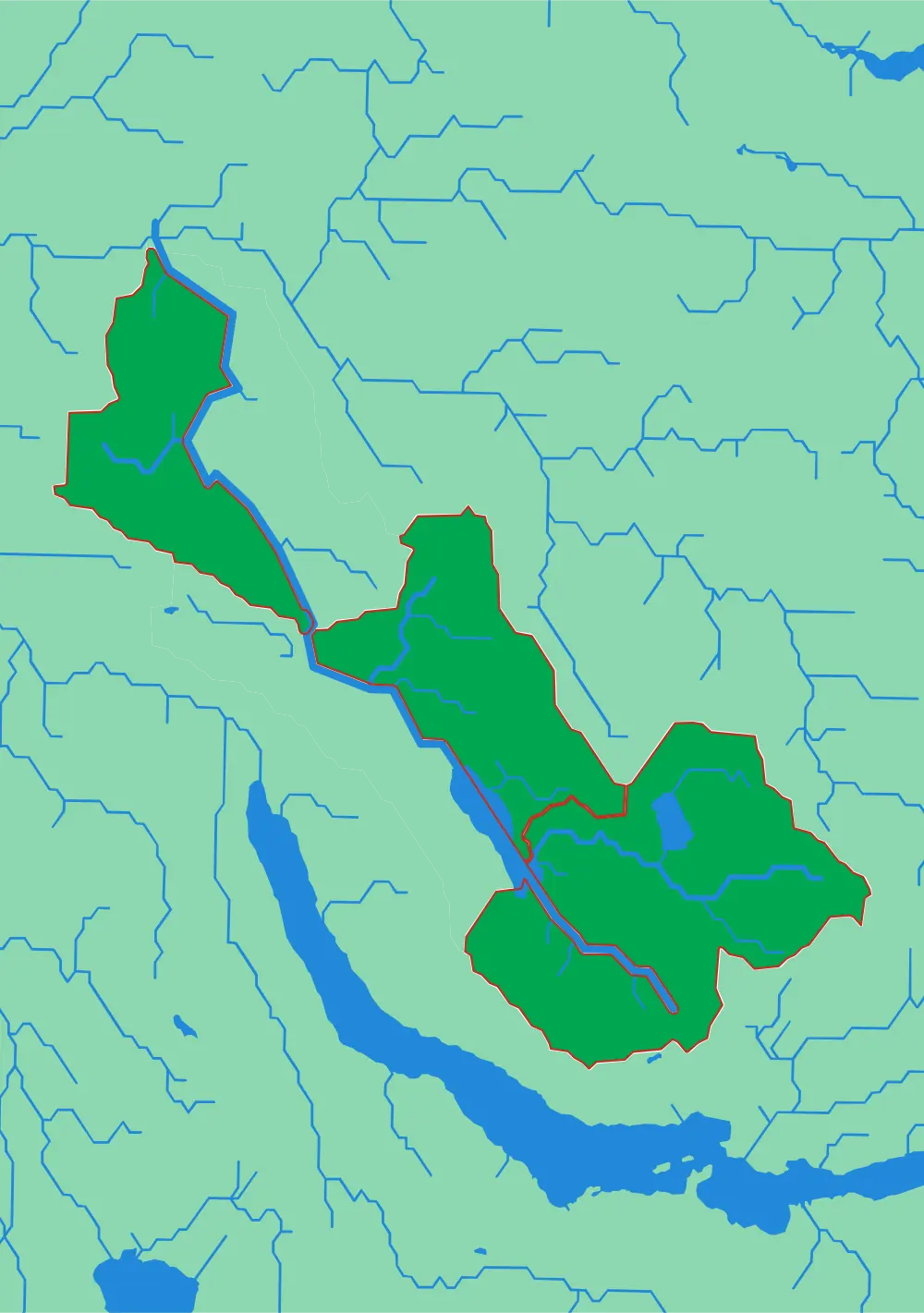
The Glatt
A small river with its own country
Three pieces. The smallest watershed in the collection, and the easiest first one.
- Pieces
- 3 pieces
- Scale
- 1 mm ≈ 228 m
- Suitable for
- Ages 5 and up
- Price
- CHF 120.00
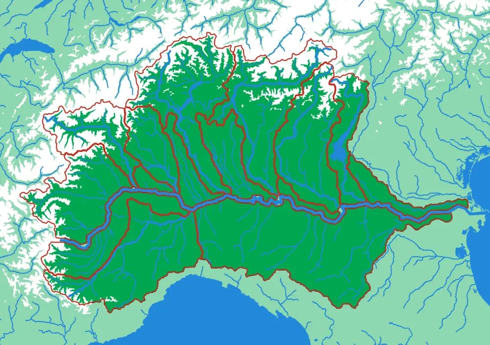
The Po
The Alps and the Apennines, draining to one plain
Fifteen pieces — the Ticino, the Adda, the Adige, the Tanaro, the Dora Baltea, the Oglio, the Sesia.
- Pieces
- 15 pieces
- Scale
- 1 mm ≈ 2.0 km
- Suitable for
- Ages 8 and up
- Price
- CHF 120.00
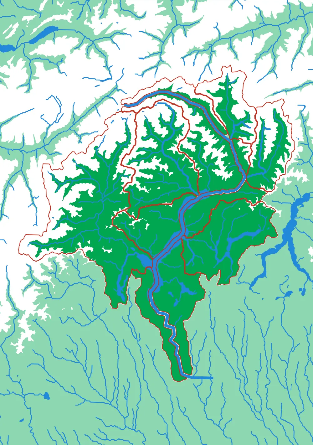
The Ticino
Both sides of the Gotthard, on one plate
Twelve pieces — the Maggia, the Toce, the Moesa, the Brenno, the Tresa — draining south from the Alpine crest into Lake Maggiore.
- Pieces
- 12 pieces
- Scale
- 1 mm ≈ 715 m
- Suitable for
- Ages 7 and up
- Price
- CHF 120.00
Countries & States
Borders laid over the ground they were drawn on.
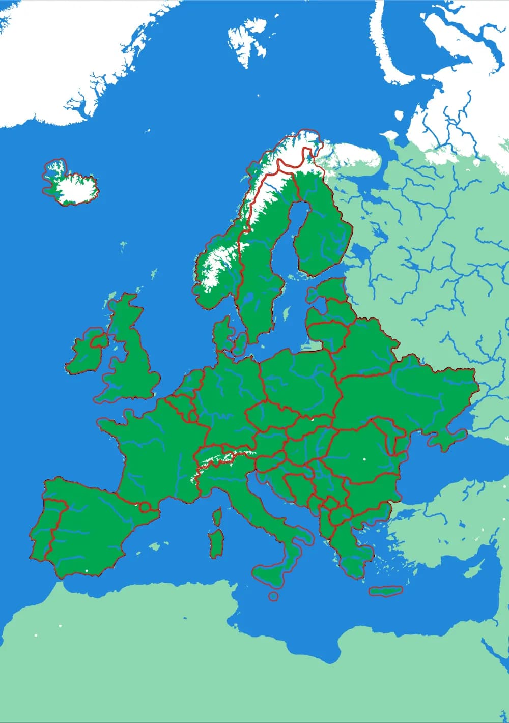
The familiar political maps — but printed at real elevation, so the border and the mountain range are in the same object. Children find out which borders follow a river or a ridge and which ones were drawn straight through terrain that did not agree.
Europe
Forty-five countries at real elevation
The political map, printed on the terrain it was drawn over. Forty-five pieces, from Andorra to Russia's western edge.
- Pieces
- 45 pieces
- Scale
- 1 mm ≈ 24.7 km
- Suitable for
- Ages 6 and up
- Price
- CHF 120.00
The United States
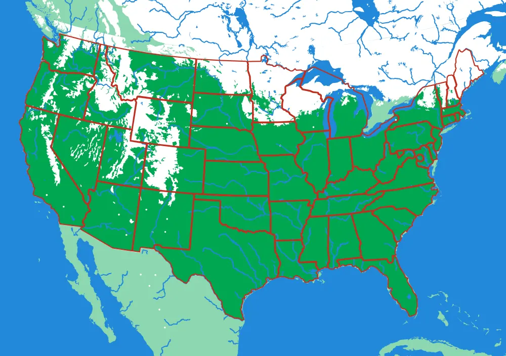
The lower forty-eight, and two pieces you would not expect
Fifty pieces. The straight western borders and the crooked eastern ones, over the ground that explains both.
- Pieces
- 50 pieces
- Scale
- 1 mm ≈ 20.1 km
- Suitable for
- Ages 6 and up
- Price
- CHF 120.00
North America
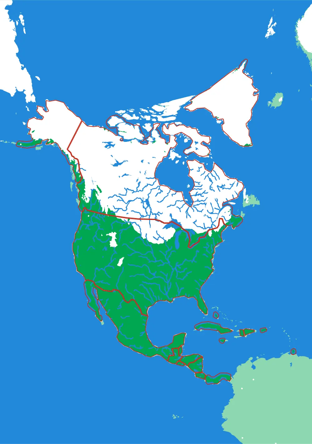
Nineteen countries, Panama to the Arctic
The continent as countries — including the Caribbean islands that are usually too small to cut.
- Pieces
- 19 pieces
- Scale
- 1 mm ≈ 49.3 km
- Suitable for
- Ages 6 and up
- Price
- CHF 120.00
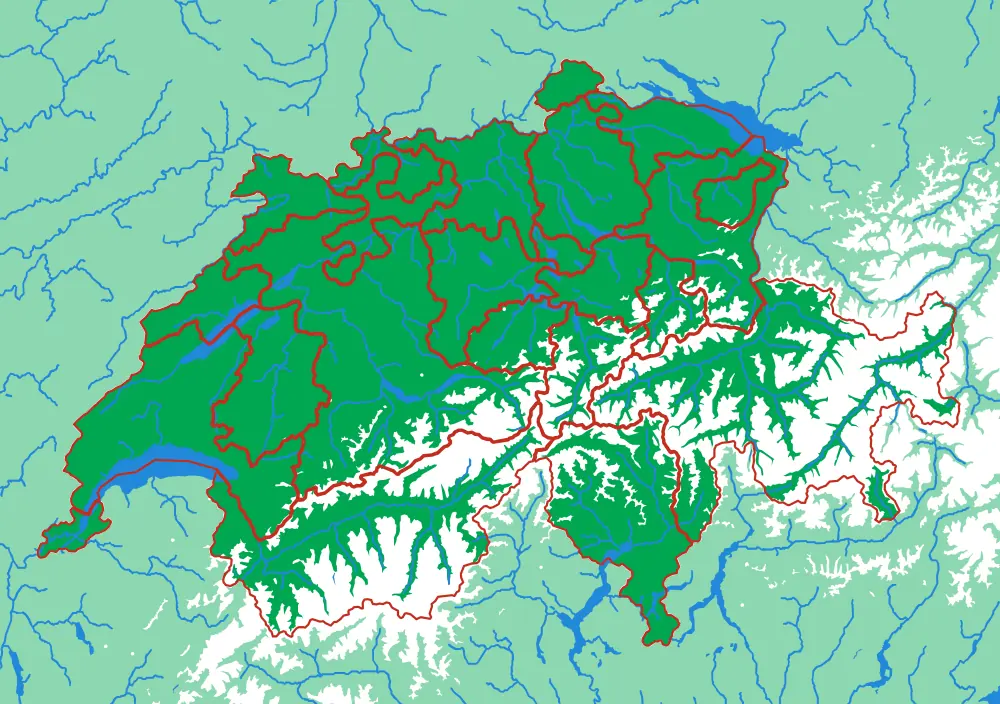
Switzerland
Twenty-three cantons over the Alps
The cantons, printed at 1 mm to 1.5 km, with the Alps in white and every major lake in blue.
- Pieces
- 23 pieces
- Scale
- 1 mm ≈ 1.5 km
- Suitable for
- Ages 6 and up
- Price
- CHF 120.00
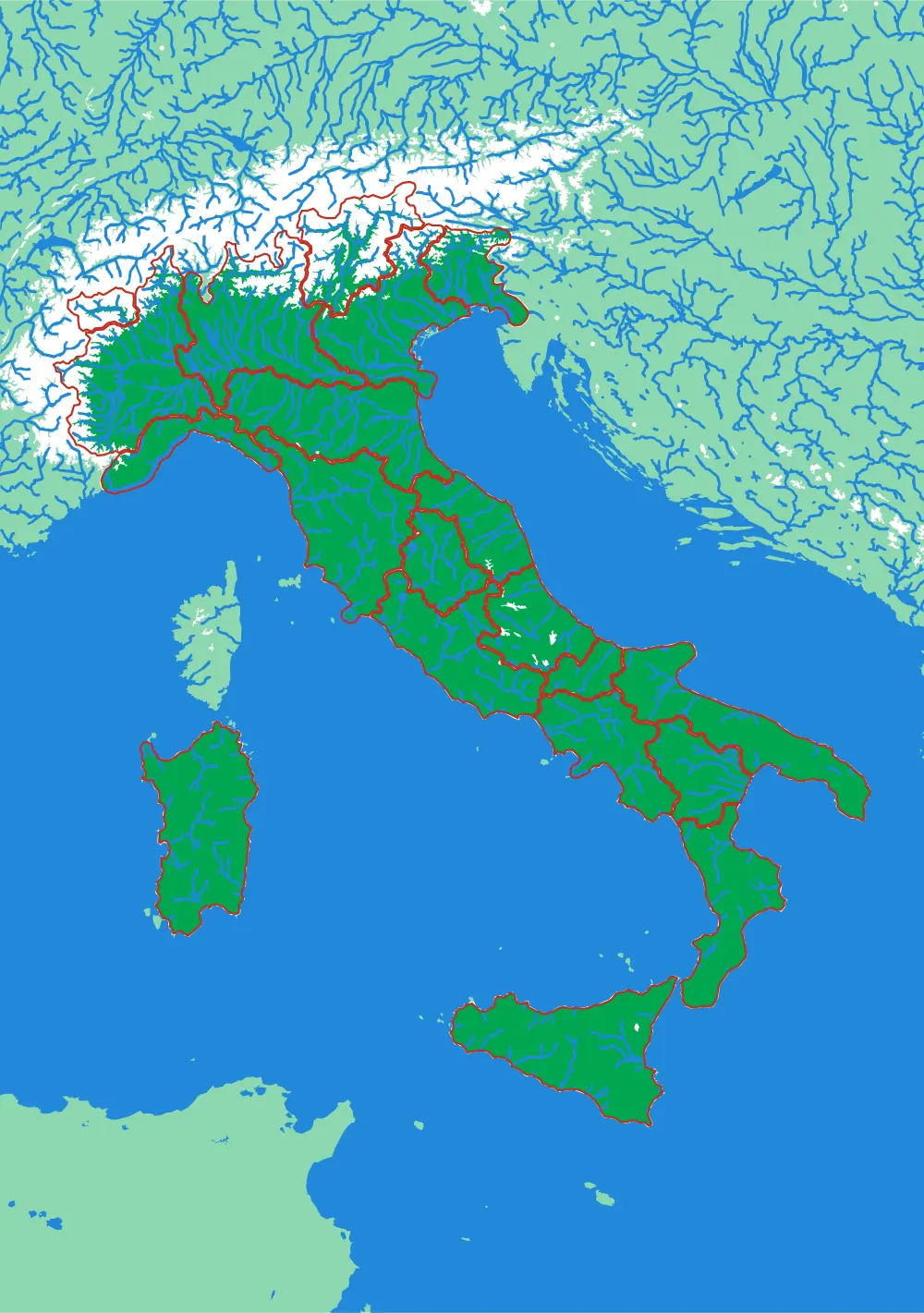
Italy
Twenty regions, one spine
The regions of Italy with the Apennines running the length of the peninsula and the Alps closing the top.
- Pieces
- 20 pieces
- Scale
- 1 mm ≈ 6.4 km
- Suitable for
- Ages 6 and up
- Price
- CHF 120.00
In development
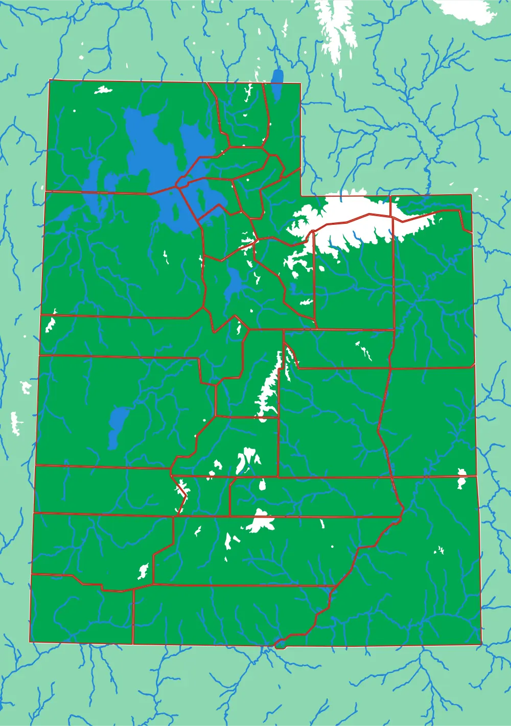
Utah
Twenty-nine counties across the Great Basin
The most rectangular counties in the collection, laid over some of the least rectangular terrain.
- Pieces
- 29 pieces
- Scale
- 1 mm ≈ 2.9 km
- Suitable for
- Ages 7 and up
- Price
- CHF 120.00
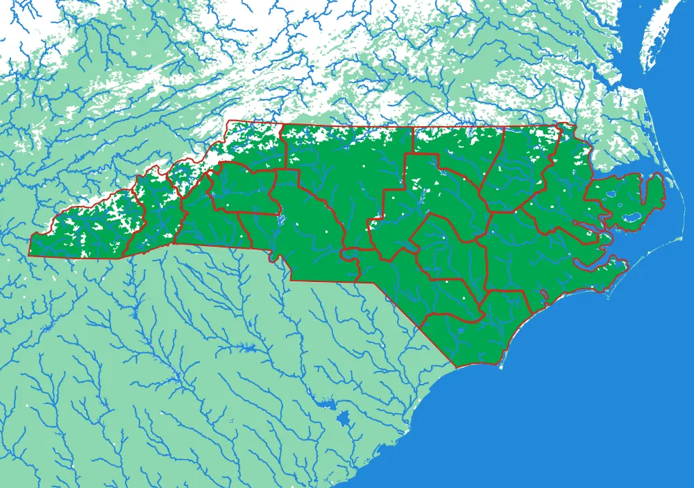
North Carolina
Sixteen regions, mountains to barrier islands
One state that runs from the highest peaks in the eastern US to the Outer Banks, in sixteen pieces.
- Pieces
- 16 pieces
- Scale
- 1 mm ≈ 3.4 km
- Suitable for
- Ages 7 and up
- Price
- CHF 120.00
Close to Home
The valley you can see from the window.
Districts, communes and townships, at a scale where a child can point to their own street. These are the puzzles that turn an abstract skill into a personal one: the first map a child truly knows is the one they live inside.
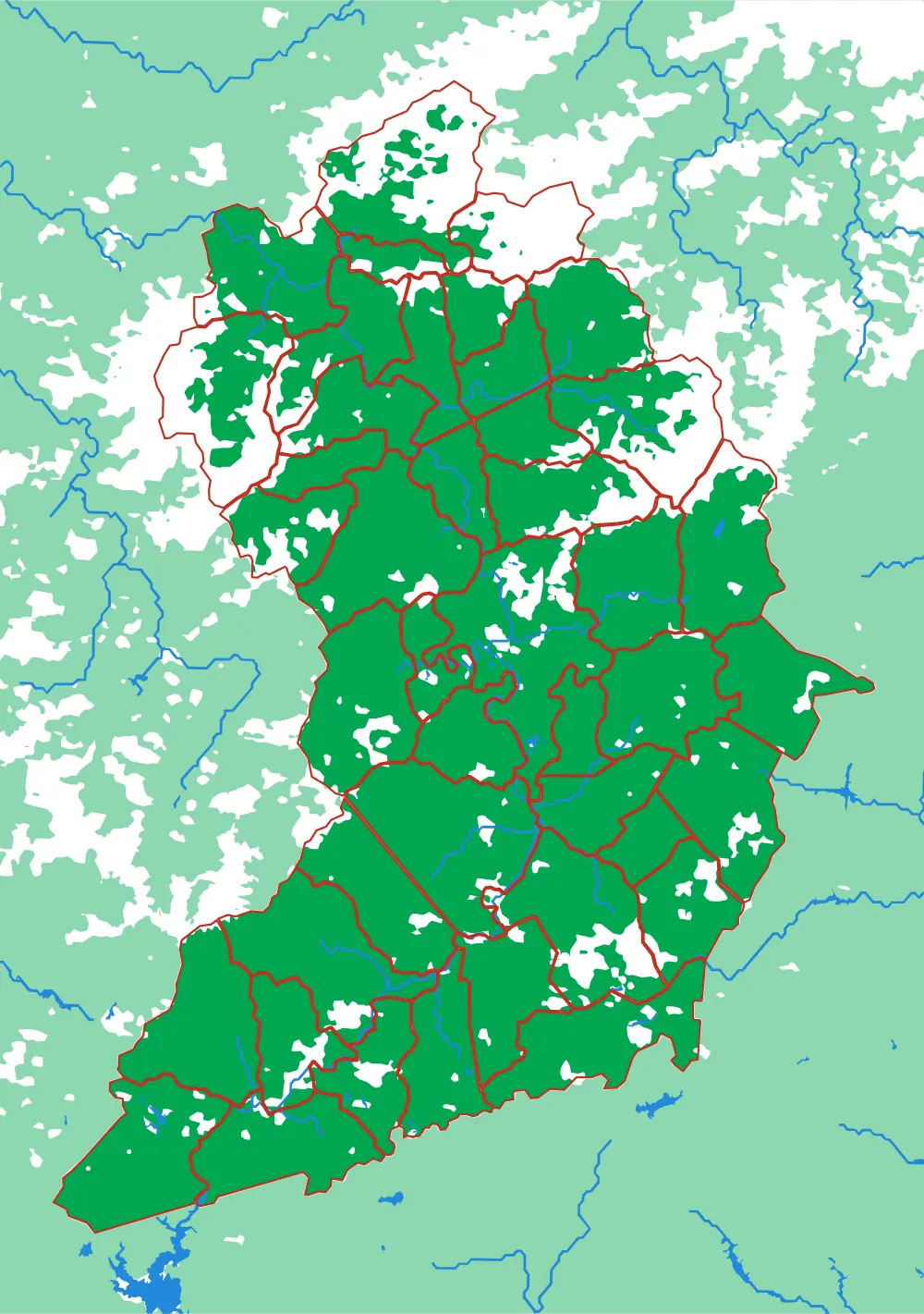
In development
Land of Sky
Forty-three townships around Asheville
The most pieces of any plate in the collection, at a scale where you can find the road you live on.
- Pieces
- 43 pieces
- Scale
- 1 mm ≈ 522 m
- Suitable for
- Ages 8 and up
- Price
- CHF 120.00
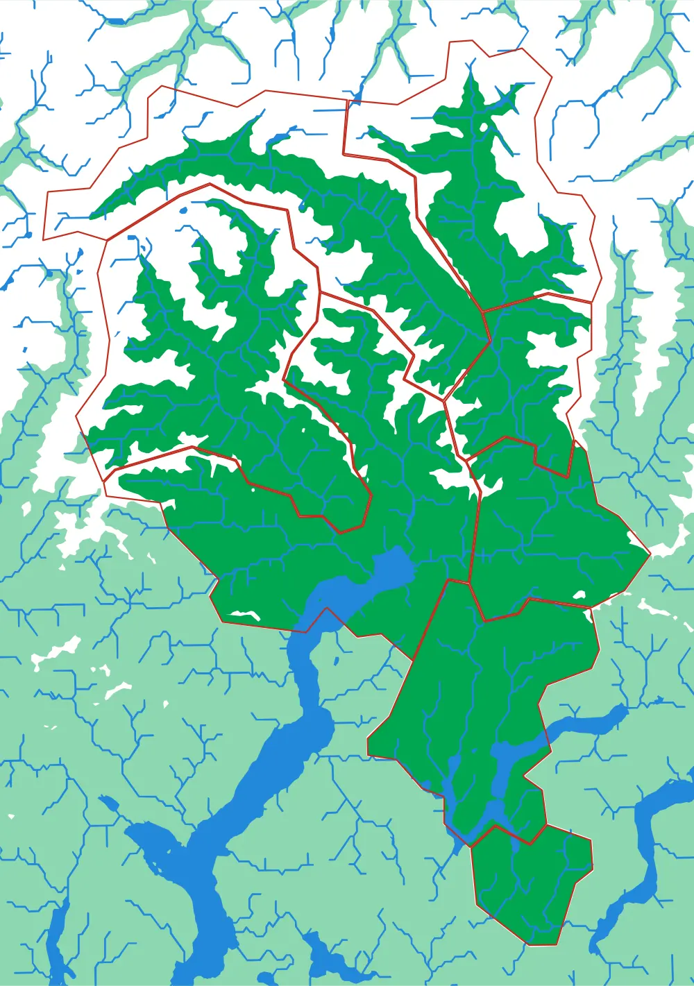
Ticino
Eight districts on the sunny side of the Alps
Bellinzona, Locarno, Lugano, Mendrisio, Blenio, Leventina, Riviera, Vallemaggia — eight pieces, all mountain.
- Pieces
- 8 pieces
- Scale
- 1 mm ≈ 387 m
- Suitable for
- Ages 6 and up
- Price
- CHF 120.00
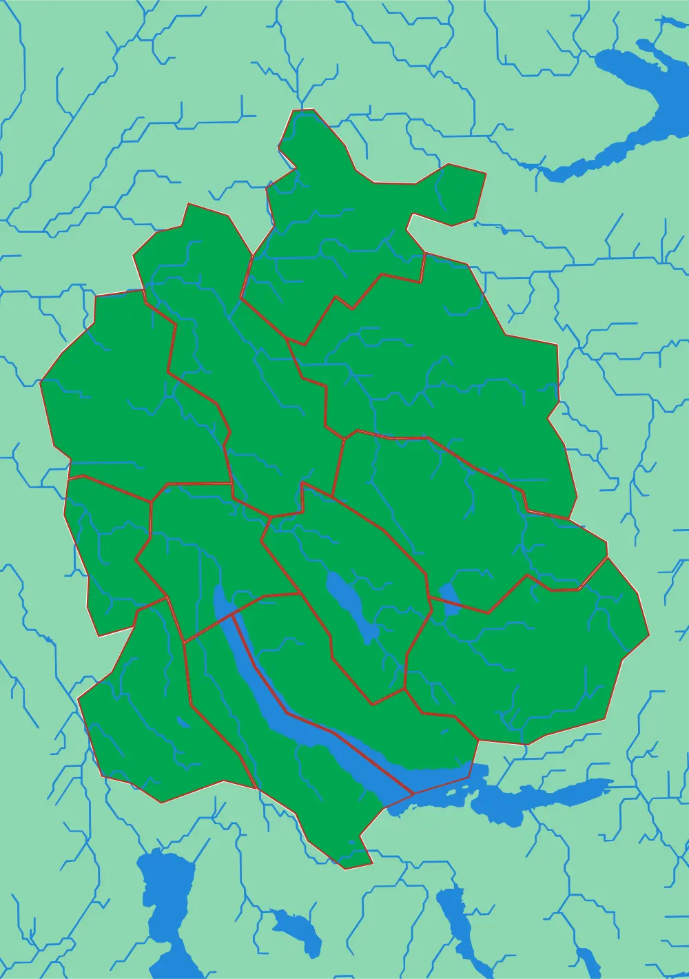
Canton Zürich
Twelve districts around the lake
The whole canton at 305 metres to the millimetre, with the lake, the Glatt valley and the Albis ridge.
- Pieces
- 12 pieces
- Scale
- 1 mm ≈ 305 m
- Suitable for
- Ages 6 and up
- Price
- CHF 120.00
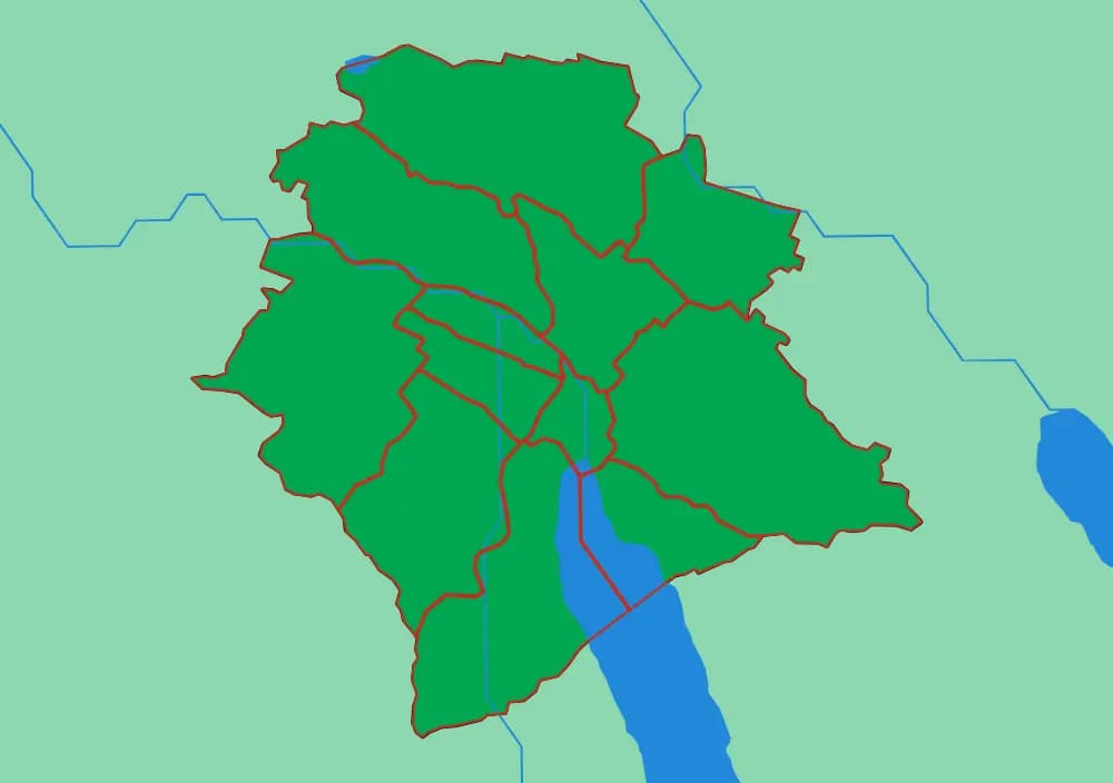
Zürich City
The twelve Kreise
The city districts at 81 metres to the millimetre — the finest scale in the collection.
- Pieces
- 12 pieces
- Scale
- 1 mm ≈ 81 m
- Suitable for
- Ages 7 and up
- Price
- CHF 120.00
In development
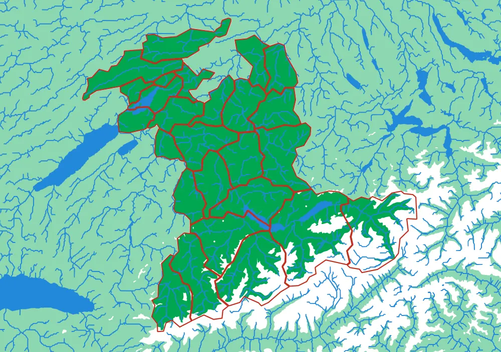
Canton Bern
Twenty-six districts, Jura to Jungfrau
The largest cantonal spread in the collection — from the folded Jura in the northwest to the high Bernese Alps.
- Pieces
- 26 pieces
- Scale
- 1 mm ≈ 724 m
- Suitable for
- Ages 7 and up
- Price
- CHF 120.00
In development
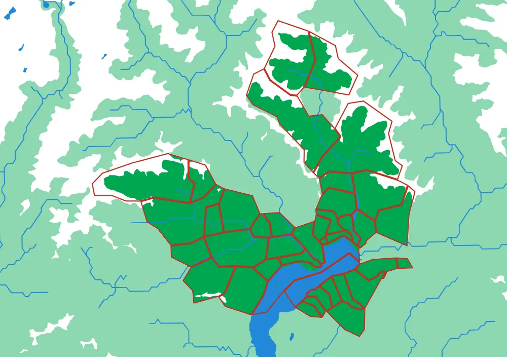
Locarno
Forty comuni above Lake Maggiore
Village-scale, at 233 metres to the millimetre: Ascona, Brissago, Corippo, the whole Verzasca.
- Pieces
- 40 pieces
- Scale
- 1 mm ≈ 233 m
- Suitable for
- Ages 9 and up
- Price
- CHF 120.00
In development
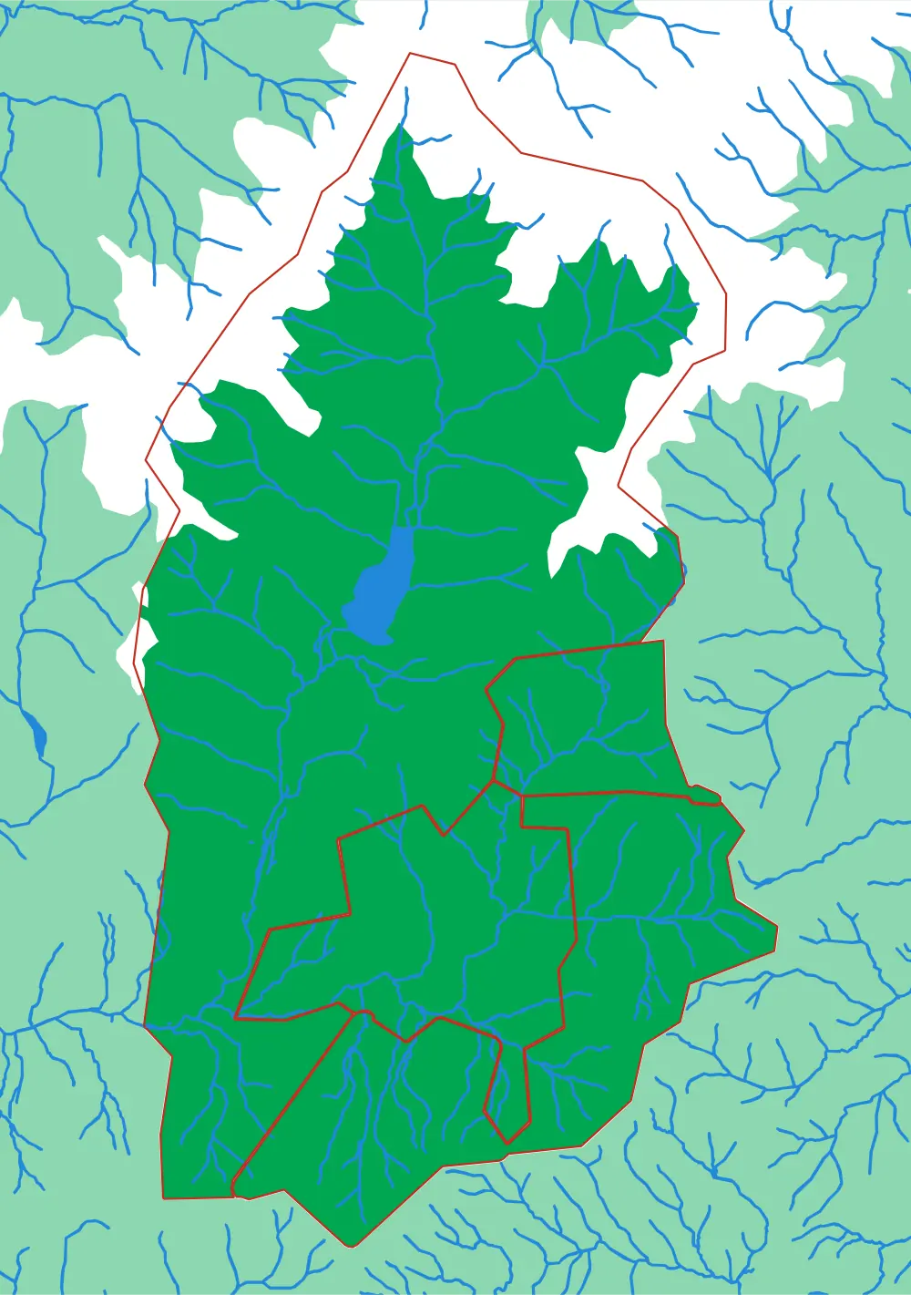
Black Mountain
Four towns in one Appalachian valley
Four pieces at 87 metres to the millimetre. Small, simple, and very local.
- Pieces
- 4 pieces
- Scale
- 1 mm ≈ 87 m
- Suitable for
- Ages 4 and up
- Price
- CHF 120.00
In development
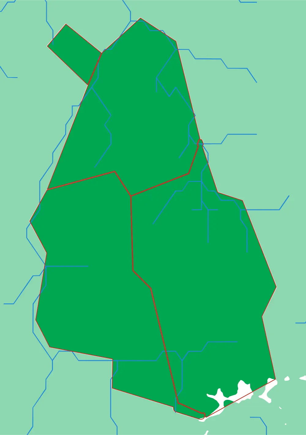
Schwarzenburg
Four communes in the Bernese pre-Alps
Albligen, Guggisberg, Rüschegg and Wahlern at 85 metres to the millimetre.
- Pieces
- 4 pieces
- Scale
- 1 mm ≈ 85 m
- Suitable for
- Ages 4 and up
- Price
- CHF 120.00
However you choose
Your selection arrives in a rack cut for it
There is no fixed set to buy into. Pick the plates that suit the ages you teach or the places you care about — six, or two, or fourteen — and the rack is cut afterwards, to that number. Six is drawn here because it is a common shape for a first shelf, not because it is a product.
Plates slide in short-side first onto their own rails, so one can come out and go back without disturbing the rest. Adding to a collection later means a second rack rather than a bigger one — the first was cut to fit what it holds.
- Drawn here
- 6 plates
- Outside
- 261 × 185 × 101 mm
- One rack holds
- up to 18
Not made yet
Other ways of dividing the world
Everything above is divided by a boundary someone drew or a ridge water runs off. Those are not the only rules available, and the ones below would each make a genuinely different object out of the same terrain.
The ocean, not the land
Invert the World plate: cut the sea into its basins and marginal seas, and let the continents be the frame that holds them. Most children have never seen the ocean drawn as a set of places with names and edges.
open data exists
Plates, not continents
The same world outline cut along plate boundaries. India arrives as a piece of its own, the Atlantic splits down the middle, and the join lines land exactly where the earthquakes are.
data already here
Where people actually are
Cut by population rather than by area, so each piece holds roughly the same number of people. The result is a map that is mostly wrong about space and exactly right about everyone on it.
open data exists
The same place, four centuries
One extent, one terrain, and a plate per era — the borders moving over ground that does not. Europe is the obvious candidate and the least comfortable one.
would need sourcing
A city, by what it is made of
Below the district scale: parks, water, built blocks, rail. Less a puzzle about geography than about how a city is assembled, at a scale where a child can find their own street.
data already here
None of these have been made. They are here because the hard part is rarely the machinery — it is deciding what the pieces should be, and then getting the cut to read at that scale. Each would take a round of real work, and each is the kind of work worth doing.