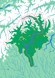
Generated from the same geometry the printer is handed — the plate seen from directly above. It cannot show the relief, which is the part you have to hold.
The Ticino
Both sides of the Gotthard, on one plate
This is the southern Alps as a drainage system, and it is a good demonstration of what a watershed map does that a political one cannot: the basin runs straight across the Swiss–Italian border as though it were not there, because for water it is not. Valleys that Ticinesi think of as quite separate places — Maggia, Verzasca, Blenio — turn out to be neighbouring pieces of a single shape.
What a child works out
- Borders stop at a ridge sometimes, and cut across one other times.
- Alpine valleys are separate because the ground between them is high.
- Lake Maggiore is the drain, and every piece leans towards it.
The plate
- Pieces
- 12 pieces
- Plate
- 176 × 250 mm
- Scale
- 1 mm ≈ 715 m
- Vertical exaggeration
- × 0.65
- Thickness
- 8.8 mm
- Smallest piece
- 120 mm²
- Fit
- 0.35 mm clearance
- Material
- PLA, printed in Switzerland
6 named; the rest are sub-basins the source data leaves unnamed.
B5 — the size of a school exercise book.
How much ground one millimetre of plate covers.
Height is compressed here — the terrain is dramatic enough at this scale that true height would not fit the plate.
Nothing is cut smaller than a child can pick up.
Printed in place, so every piece seats first time without sanding.
Every named piece
- Brenno
- Maggia
- Moesa
- Rhein
- Toce
- Tresa
More from Watersheds
See all →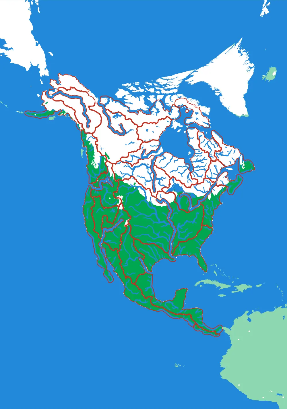
North America by River
A continent divided only by where water goes
No countries, no states. Twenty-nine pieces, each one the whole territory that drains into a single river.
- Pieces
- 29 pieces
- Scale
- 1 mm ≈ 49.4 km
- Suitable for
- Ages 8 and up
- Price
- CHF 120.00
The Mississippi
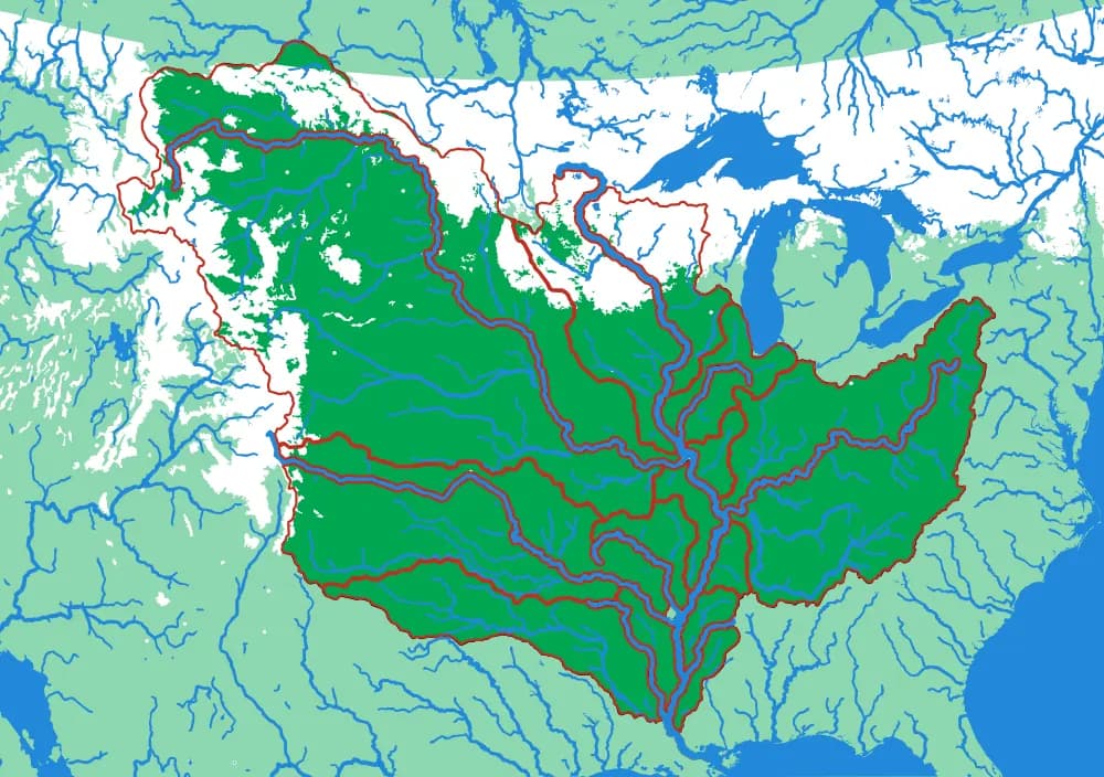
The basin that drains a third of a continent
Fifteen pieces — Missouri, Ohio, Arkansas, Red, Illinois — that together are about three million square kilometres of drainage.
- Pieces
- 15 pieces
- Scale
- 1 mm ≈ 14.5 km
- Suitable for
- Ages 8 and up
- Price
- CHF 120.00
The Ohio
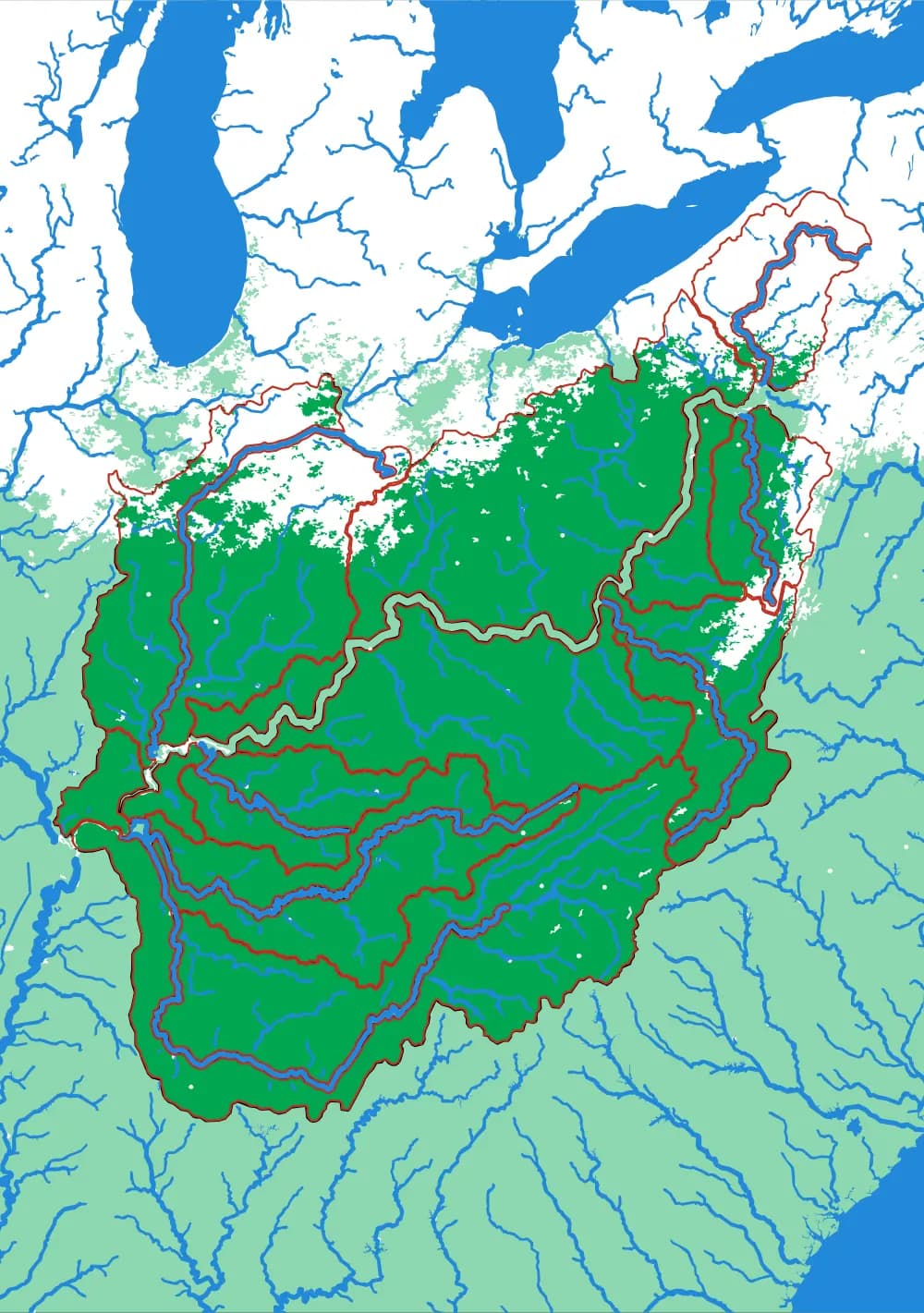
Where the Appalachians drain west
Eighteen pieces: the Tennessee, the Cumberland, the Allegheny, the Monongahela, the Wabash and the ridges between them.
- Pieces
- 18 pieces
- Scale
- 1 mm ≈ 5.8 km
- Suitable for
- Ages 8 and up
- Price
- CHF 120.00