Relief puzzle maps
35 puzzles, 602 pieces
Each plate is B5 — the size of a school exercise book — and each piece is a real place at its real height. Grouped by what the cuts follow: continents, watersheds, borders, or the ground you can see from the window.
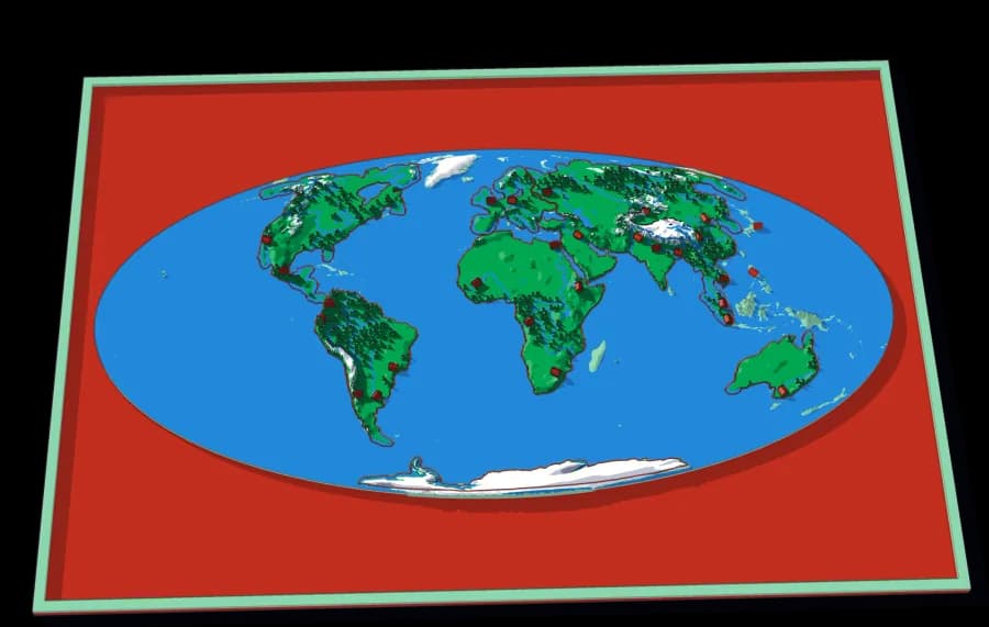
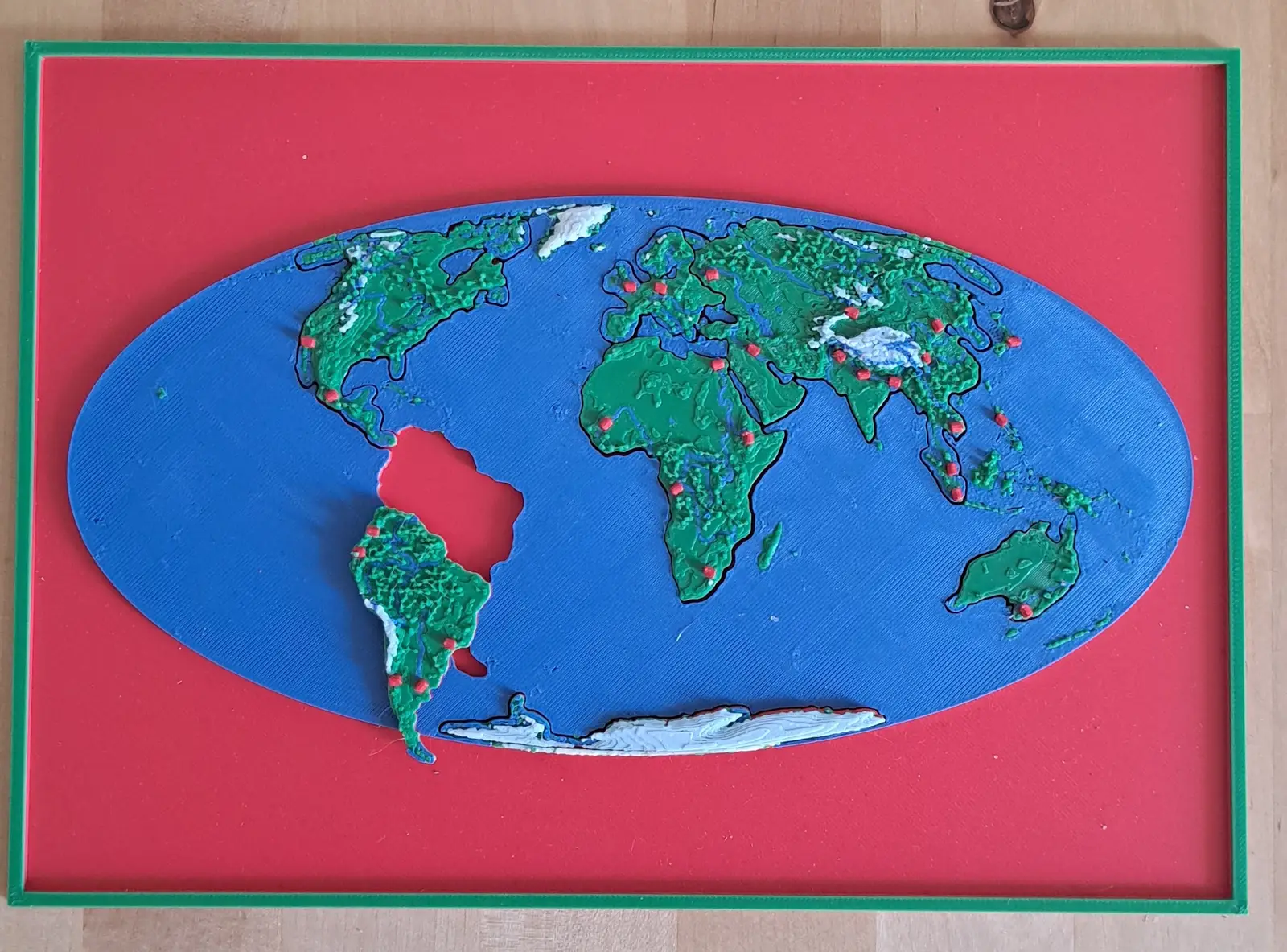
The World
Where every other puzzle sits.
One plate, seven continents, and the whole ocean around them. This is the map a child reaches for first and keeps coming back to, because every other puzzle in the collection is somewhere on it.
Watersheds
Maps of where the water goes.
A watershed is the most useful shape in geography and almost nobody is taught it: all the land whose rain ends up in the same river. These puzzles have no political borders at all. Every cut follows a ridge line, and every piece is one tributary's country. Assemble one and you have physically built a river system out of the land that feeds it.
North America by River
A continent divided only by where water goes
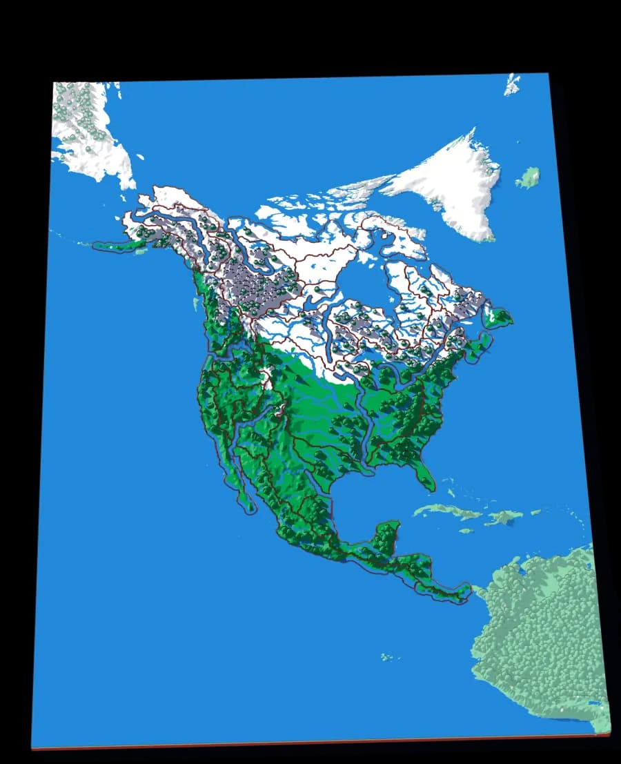
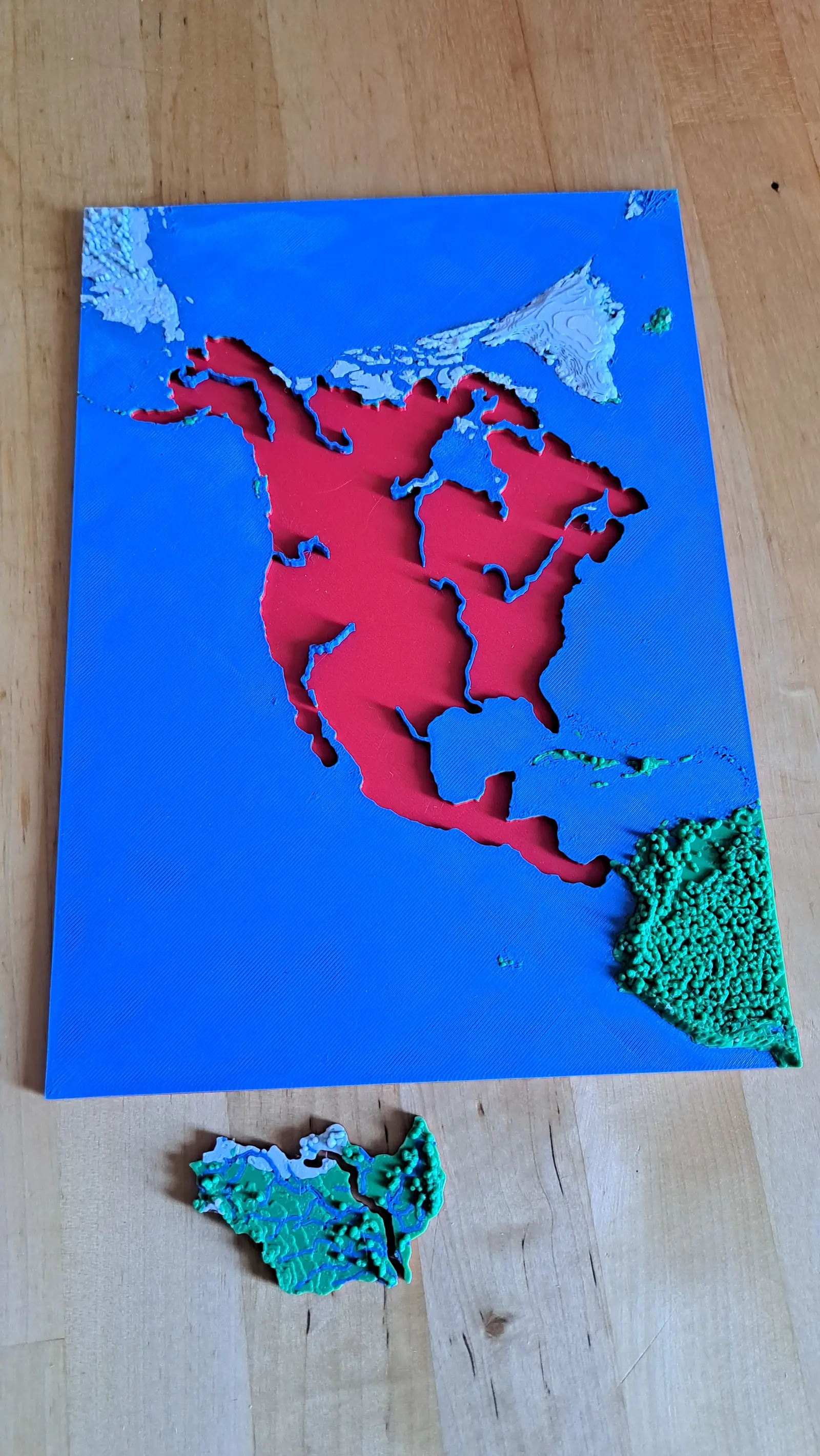
No countries, no states. Twenty-nine pieces, each one the whole territory that drains into a single river.
- Pieces
- 29 pieces
- Scale
- 1 mm ≈ 49.4 km
- Suitable for
- Ages 8 and up
- Price
- CHF 15.00
The Mississippi
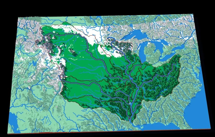
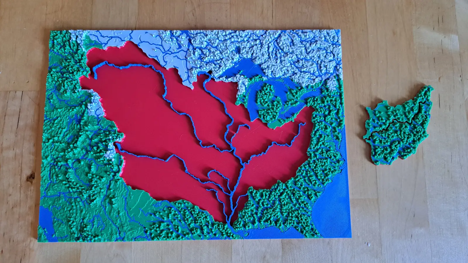
The basin that drains a third of a continent
Fifteen pieces — Missouri, Ohio, Arkansas, Red, Illinois — that together are about three million square kilometres of drainage.
- Pieces
- 13 pieces
- Scale
- 1 mm ≈ 14.5 km
- Suitable for
- Ages 8 and up
- Price
- CHF 15.00
The Upper Mississippi
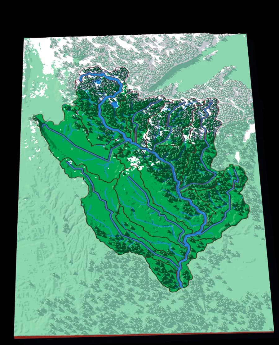
The river before the Missouri joins it
Twenty-one pieces — the Minnesota, the St Croix, the Wisconsin, the Des Moines, the Cedar — draining the northern half of the Mississippi.
- Pieces
- 16 pieces
- Scale
- 1 mm ≈ 4.7 km
- Suitable for
- Ages 8 and up
- Price
- CHF 15.00
The Ohio
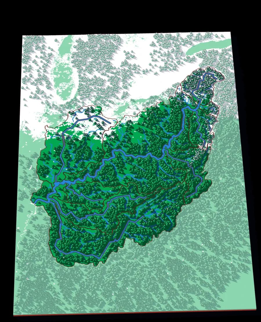
Where the Appalachians drain west
Eighteen pieces: the Tennessee, the Cumberland, the Allegheny, the Monongahela, the Wabash and the ridges between them.
- Pieces
- 14 pieces
- Scale
- 1 mm ≈ 5.8 km
- Suitable for
- Ages 8 and up
- Price
- CHF 15.00
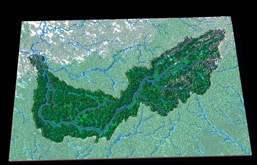
The Tennessee
The river that goes the wrong way
Seventeen pieces including the French Broad, the Holston, the Clinch, the Little Tennessee and the Hiwassee.
- Pieces
- 13 pieces
- Scale
- 1 mm ≈ 2.8 km
- Suitable for
- Ages 8 and up
- Price
- CHF 15.00
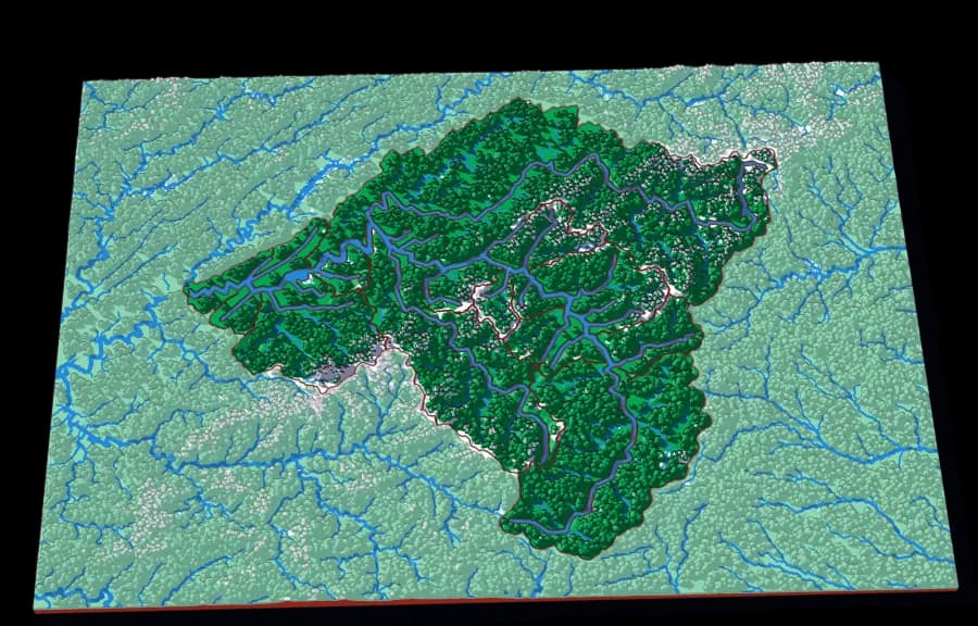
The French Broad
Older than the mountains it runs through
Seventeen pieces around Asheville — the Swannanoa, the Pigeon, the Nolichucky, Big Laurel, the Ivy.
- Pieces
- 18 pieces
- Scale
- 1 mm ≈ 976 m
- Suitable for
- Ages 8 and up
- Price
- CHF 15.00
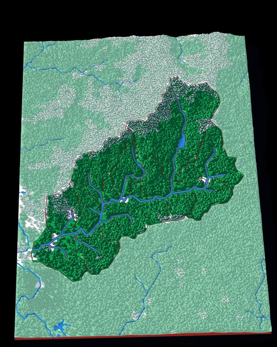
The Swannanoa
One valley, fifteen creeks
The deepest zoom in the collection: a single Appalachian valley, cut into the fifteen creek basins that make it.
- Pieces
- 15 pieces
- Scale
- 1 mm ≈ 163 m
- Suitable for
- Ages 9 and up
- Price
- CHF 15.00
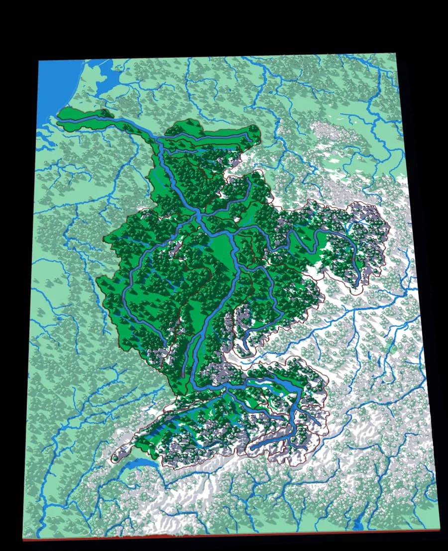
The Rhine
From the Alps to the North Sea
Twenty pieces — the Aare, the Main, the Neckar, the Mosel — crossing six countries without showing one of them.
- Pieces
- 22 pieces
- Scale
- 1 mm ≈ 3.4 km
- Suitable for
- Ages 8 and up
- Price
- CHF 15.00
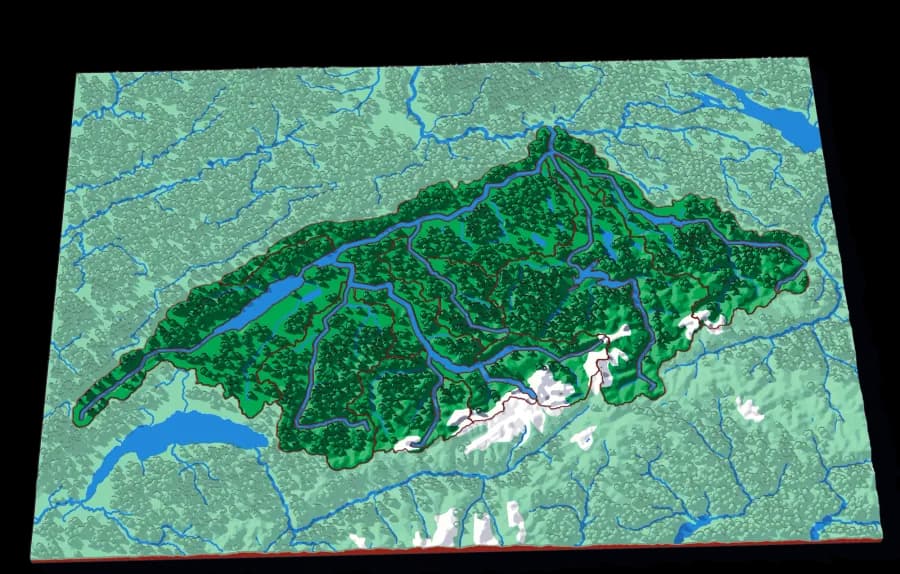
The Aare
Switzerland's own river, whole
Fifteen pieces — the Reuss, the Limmat, the Saane, the Zihl — covering most of the Swiss plateau.
- Pieces
- 15 pieces
- Scale
- 1 mm ≈ 1.1 km
- Suitable for
- Ages 7 and up
- Price
- CHF 15.00
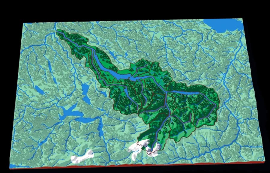
The Limmat
Zürich's water, from the Glarus Alps down
Fifteen pieces following the Linth and the Limmat from the high Alps through the lake and out past Zürich.
- Pieces
- 15 pieces
- Scale
- 1 mm ≈ 517 m
- Suitable for
- Ages 7 and up
- Price
- CHF 15.00
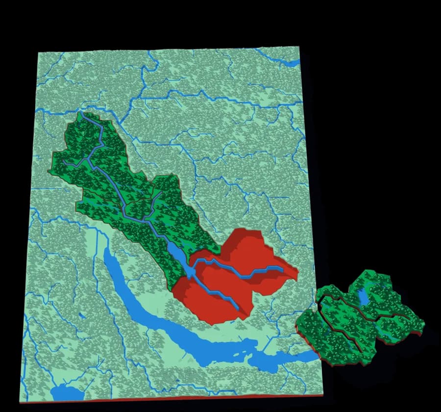
The Glatt
A small river with its own country
Three pieces. The smallest watershed in the collection, and the easiest first one.
- Pieces
- 5 pieces
- Scale
- 1 mm ≈ 228 m
- Suitable for
- Ages 5 and up
- Price
- CHF 15.00
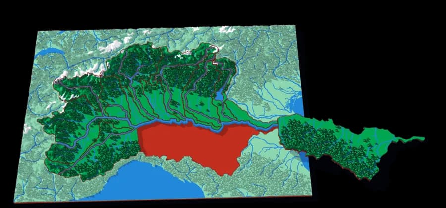
The Po
The Alps and the Apennines, draining to one plain
Fifteen pieces — the Ticino, the Adda, the Adige, the Tanaro, the Dora Baltea, the Oglio, the Sesia.
- Pieces
- 15 pieces
- Scale
- 1 mm ≈ 2.0 km
- Suitable for
- Ages 8 and up
- Price
- CHF 15.00
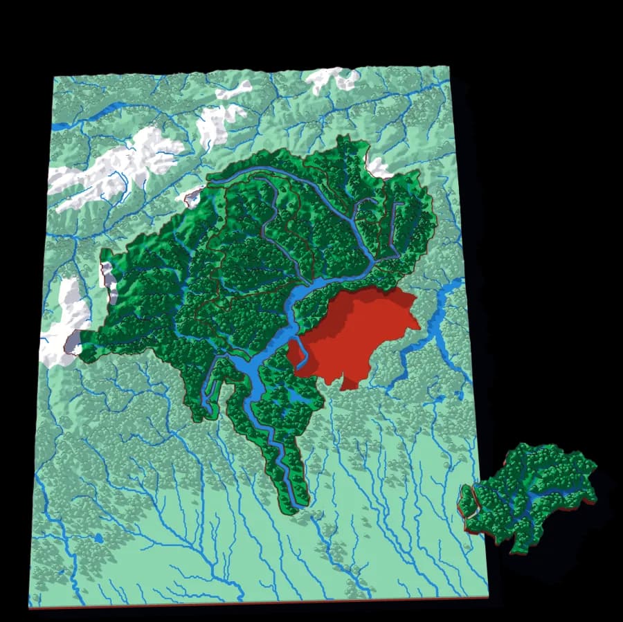
The Ticino
Both sides of the Gotthard, on one plate
Twelve pieces — the Maggia, the Toce, the Moesa, the Brenno, the Tresa — draining south from the Alpine crest into Lake Maggiore.
- Pieces
- 12 pieces
- Scale
- 1 mm ≈ 715 m
- Suitable for
- Ages 7 and up
- Price
- CHF 15.00
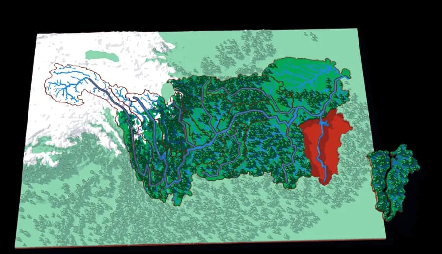
The Yangtze
From the Tibetan Plateau to the East China Sea
Twenty-one pieces — the Jinsha, the Jialing, the Wu, the Han, the Gan — the basin of the longest river in Asia.
- Pieces
- 16 pieces
- Scale
- 1 mm ≈ 11.2 km
- Suitable for
- Ages 8 and up
- Price
- CHF 15.00
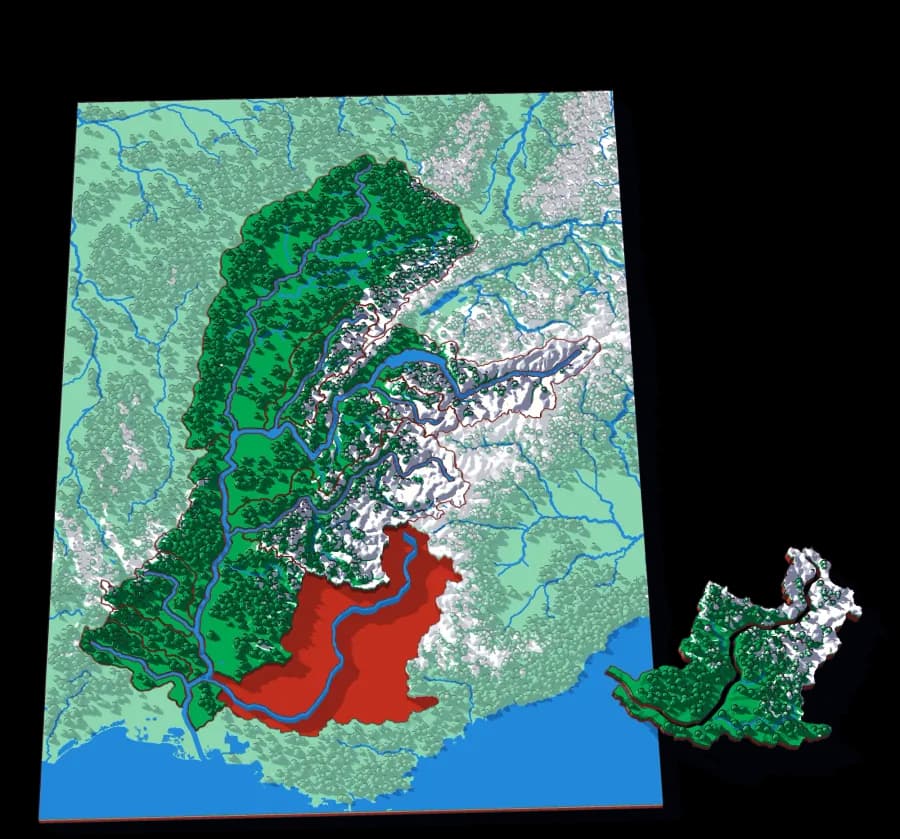
The Rhône
From the Rhône Glacier to the Mediterranean
The Saône, the Isère, the Durance, the Arve, the Ardèche: the basin of the river that leaves the Alps through Lake Geneva and turns south at Lyon.
- Pieces
- 13 pieces
- Scale
- 1 mm ≈ 2.5 km
- Suitable for
- Ages 8 and up
- Price
- CHF 15.00
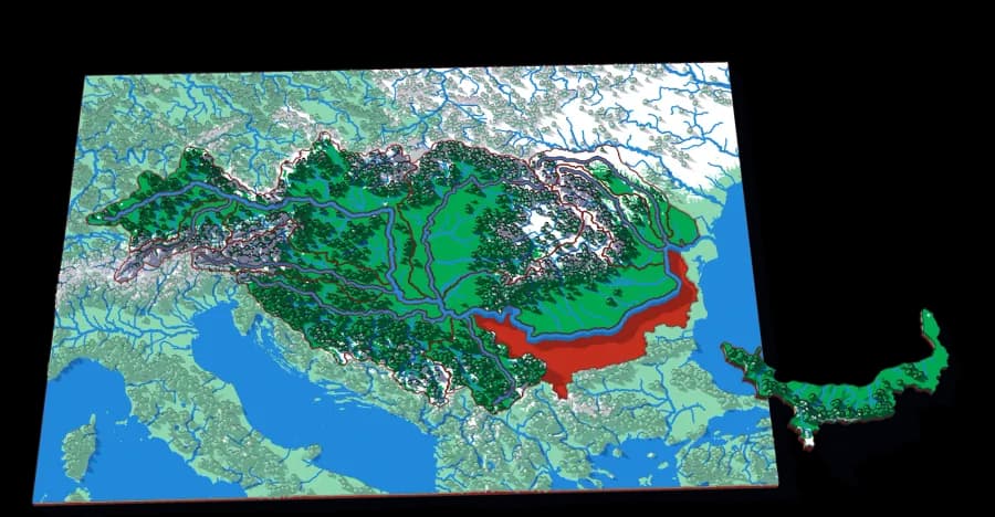
The Danube
From the Black Forest to the Black Sea
The Inn, the Drava, the Tisza, the Sava, the Morava, the Prut: the basin of the river that flows through more countries than any other.
- Pieces
- 12 pieces
- Scale
- 1 mm ≈ 7.2 km
- Suitable for
- Ages 8 and up
- Price
- CHF 15.00
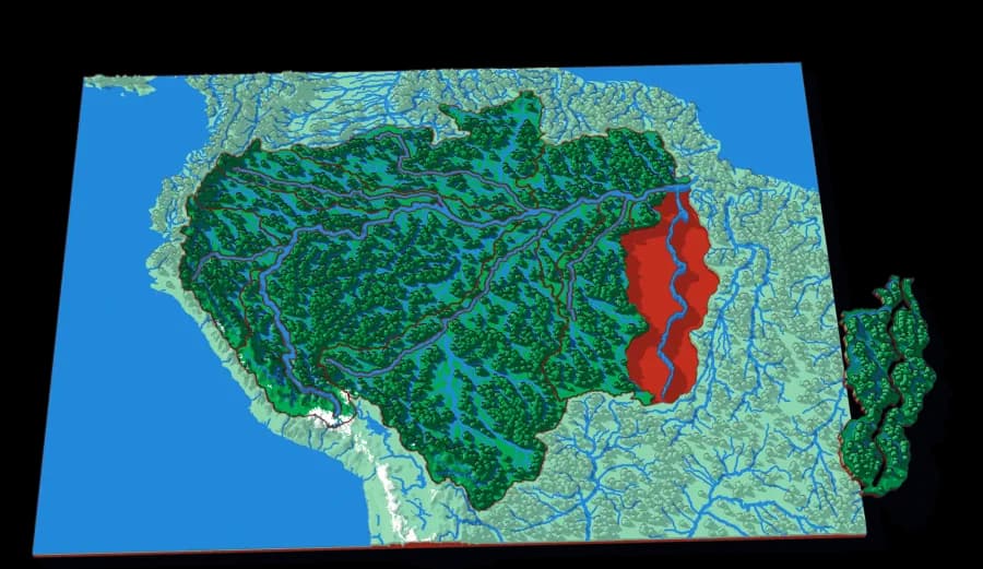
The Amazon
From the Andes to the Atlantic
The Madeira, the Negro, the Japurá, the Marañón, the Tapajós, the Xingu: the basin of the largest river on Earth.
- Pieces
- 12 pieces
- Scale
- 1 mm ≈ 18.4 km
- Suitable for
- Ages 8 and up
- Price
- CHF 15.00
Countries & States
Borders laid over the ground they were drawn on.
The familiar political maps — but printed at real elevation, so the border and the mountain range are in the same object. Children find out which borders follow a river or a ridge and which ones were drawn straight through terrain that did not agree.
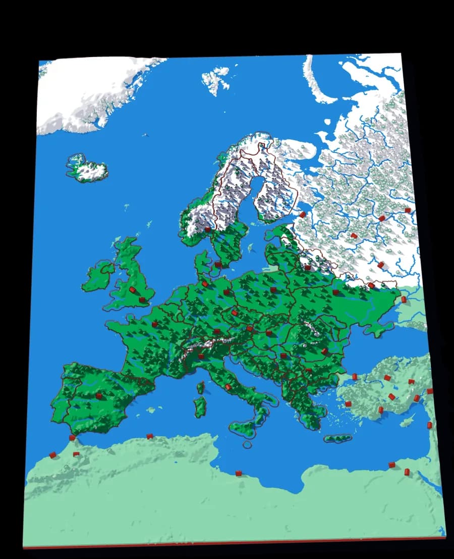
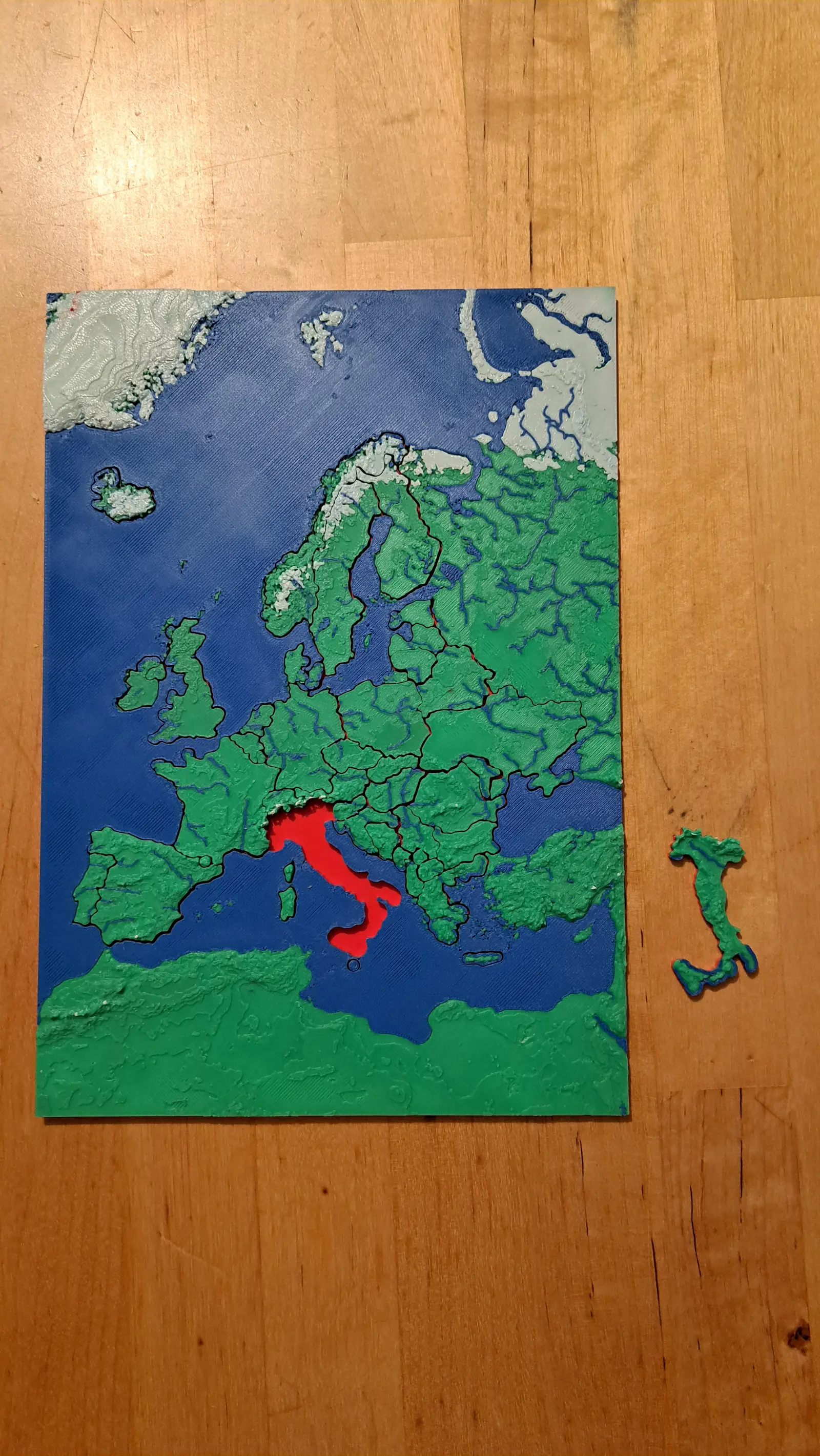
Europe
Forty-five countries at real elevation
The political map, printed on the terrain it was drawn over. Forty-five pieces, from Andorra to Russia's western edge.
- Pieces
- 29 pieces
- Scale
- 1 mm ≈ 24.7 km
- Suitable for
- Ages 6 and up
- Price
- CHF 15.00
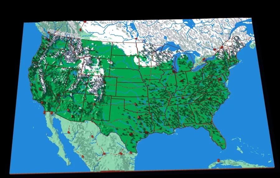
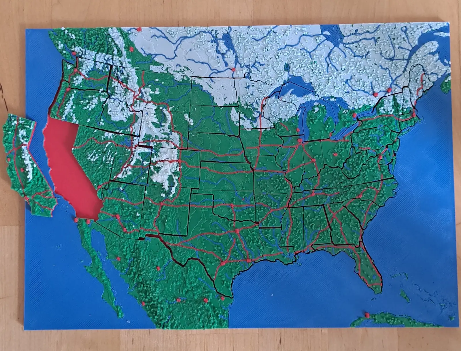
The United States
The lower forty-eight, and two pieces you would not expect
Fifty pieces. The straight western borders and the crooked eastern ones, over the ground that explains both.
- Pieces
- 46 pieces
- Scale
- 1 mm ≈ 20.1 km
- Suitable for
- Ages 6 and up
- Price
- CHF 15.00
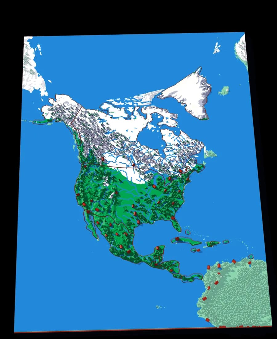
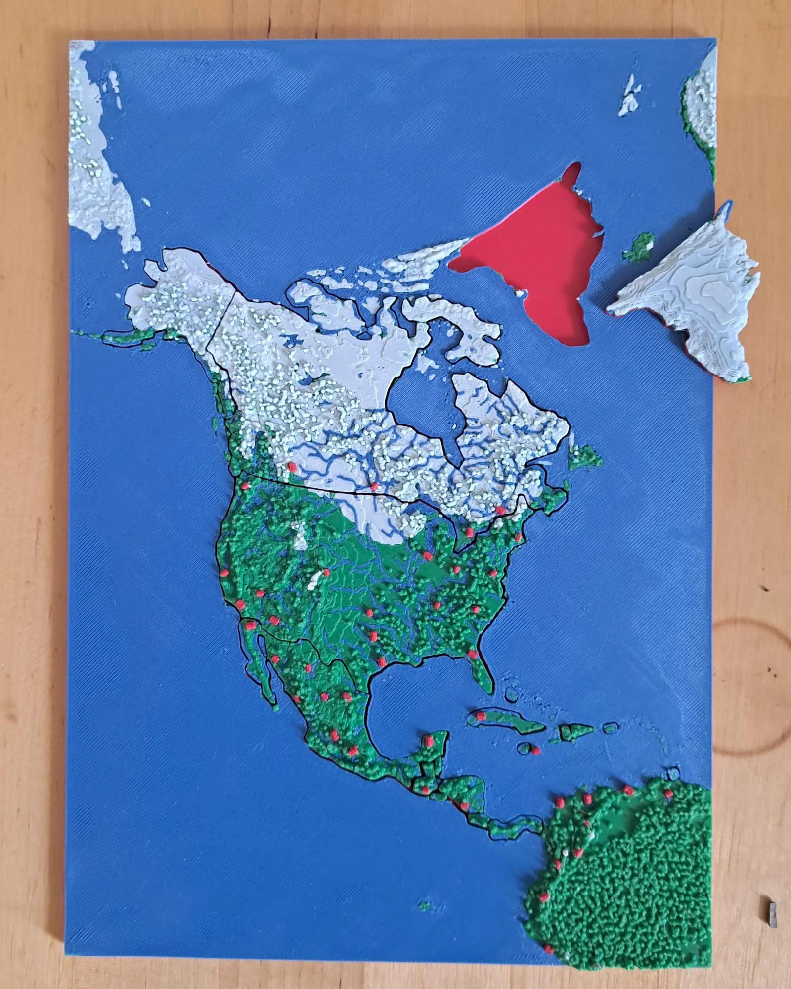
North America
Nineteen countries, Panama to the Arctic
The continent as countries — including the Caribbean islands that are usually too small to cut.
- Pieces
- 6 pieces
- Scale
- 1 mm ≈ 49.3 km
- Suitable for
- Ages 6 and up
- Price
- CHF 15.00
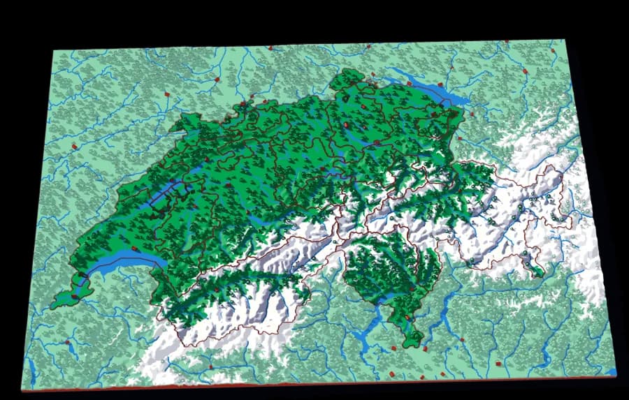
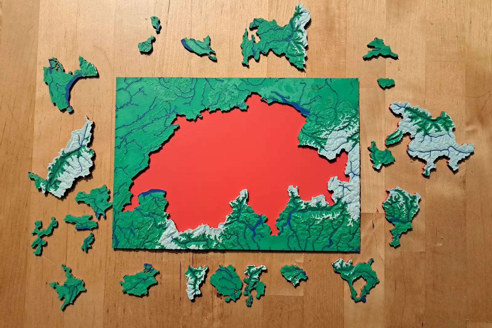
Switzerland
Twenty-three cantons over the Alps
The cantons, printed at 1 mm to 1.5 km, with the Alps in white and every major lake in blue.
- Pieces
- 23 pieces
- Scale
- 1 mm ≈ 1.5 km
- Suitable for
- Ages 6 and up
- Price
- CHF 15.00
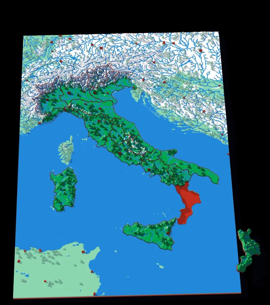
Italy
Twenty regions, one spine
The regions of Italy with the Apennines running the length of the peninsula and the Alps closing the top.
- Pieces
- 20 pieces
- Scale
- 1 mm ≈ 6.4 km
- Suitable for
- Ages 6 and up
- Price
- CHF 15.00
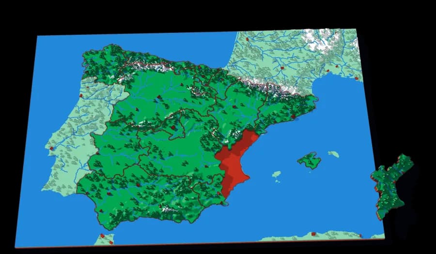
Spain
Sixteen communities on a high plateau
The autonomous communities of mainland Spain and the Balearics, from Galicia to Cataluña, around the Meseta in the middle.
- Pieces
- 16 pieces
- Scale
- 1 mm ≈ 5.7 km
- Suitable for
- Ages 6 and up
- Price
- CHF 15.00
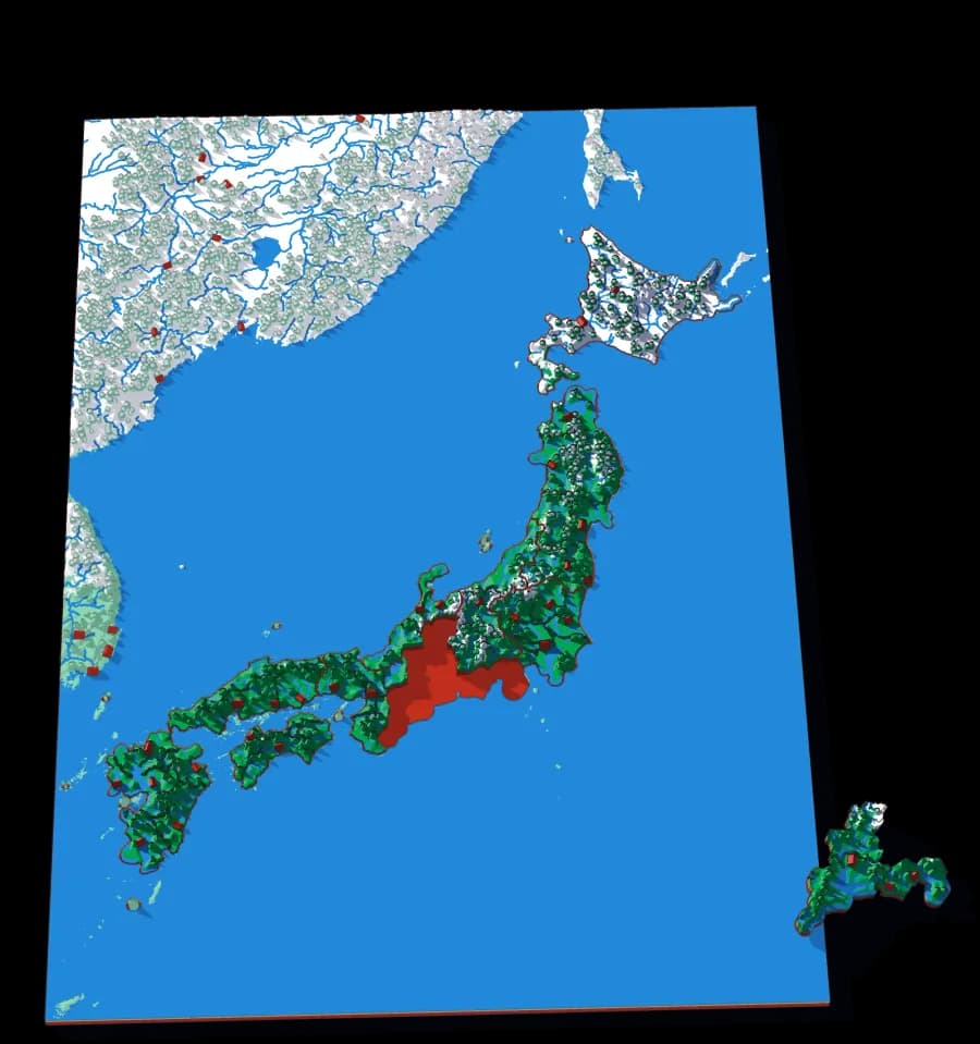
Japan
Ten regions across four main islands
The ten regions of Japan's main islands, from snowy Hokkaido to Kyushu, with every prefecture border drawn into them.
- Pieces
- 10 pieces
- Scale
- 1 mm ≈ 9.0 km
- Suitable for
- Ages 6 and up
- Price
- CHF 15.00
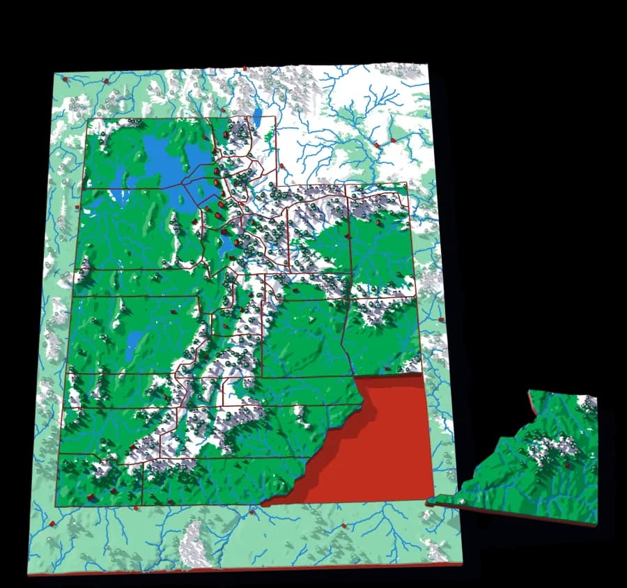
Utah
Twenty-nine counties across the Great Basin
The most rectangular counties in the collection, laid over some of the least rectangular terrain.
- Pieces
- 29 pieces
- Scale
- 1 mm ≈ 2.9 km
- Suitable for
- Ages 7 and up
- Price
- CHF 15.00
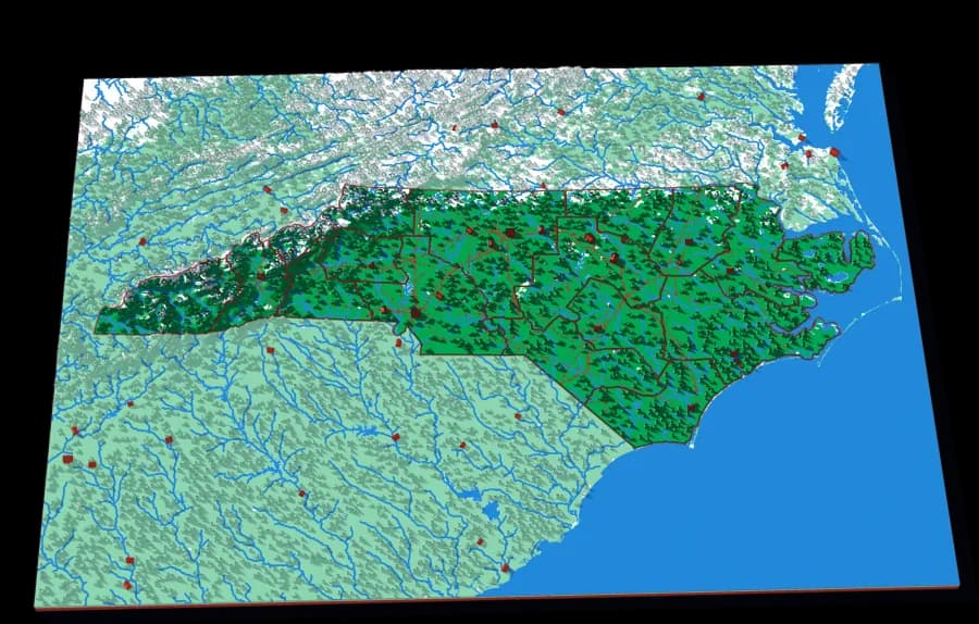
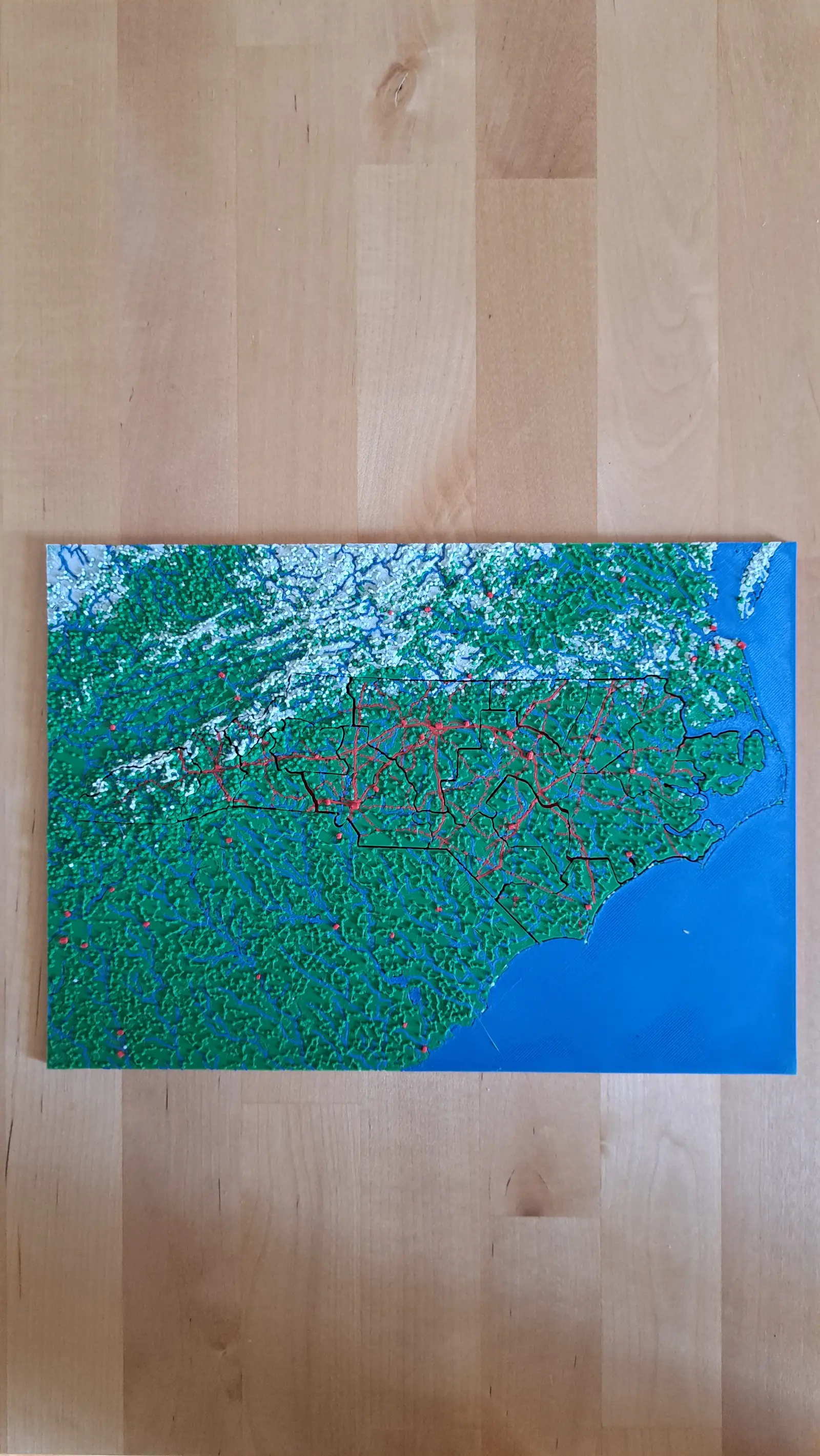
North Carolina
Sixteen regions, mountains to barrier islands
One state that runs from the highest peaks in the eastern US to the Outer Banks, in sixteen pieces.
- Pieces
- 16 pieces
- Scale
- 1 mm ≈ 3.4 km
- Suitable for
- Ages 7 and up
- Price
- CHF 15.00
Close to Home
The valley you can see from the window.
Districts, communes and townships, at a scale where a child can point to their own street. These are the puzzles that turn an abstract skill into a personal one: the first map a child truly knows is the one they live inside.
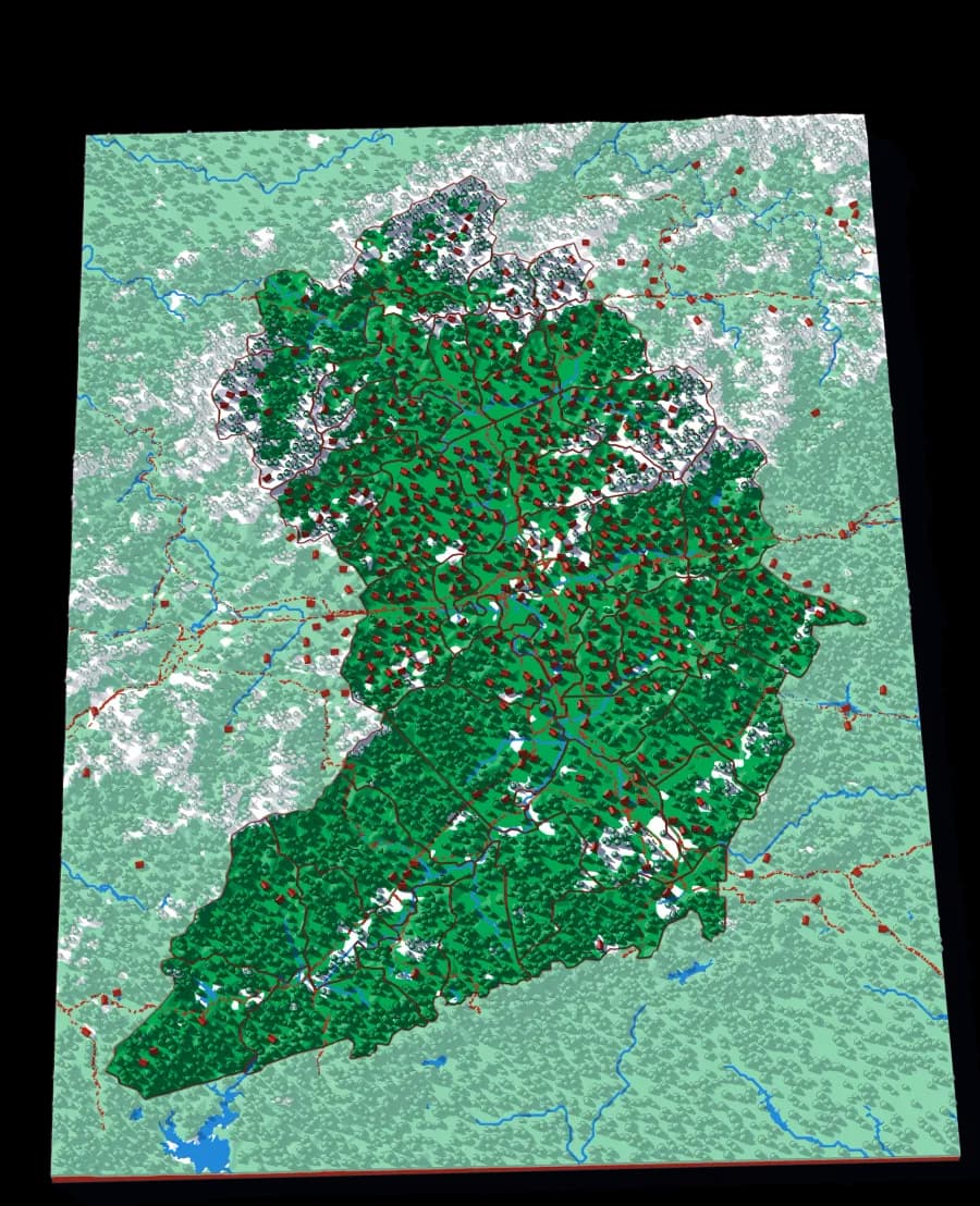
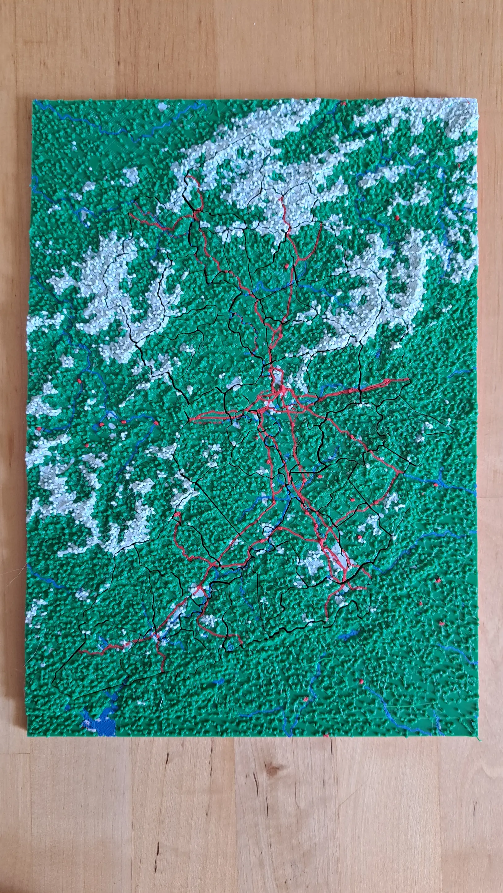
Land of Sky
Forty-three townships around Asheville
The most pieces of any plate in the collection, at a scale where you can find the road you live on.
- Pieces
- 43 pieces
- Scale
- 1 mm ≈ 522 m
- Suitable for
- Ages 8 and up
- Price
- CHF 15.00
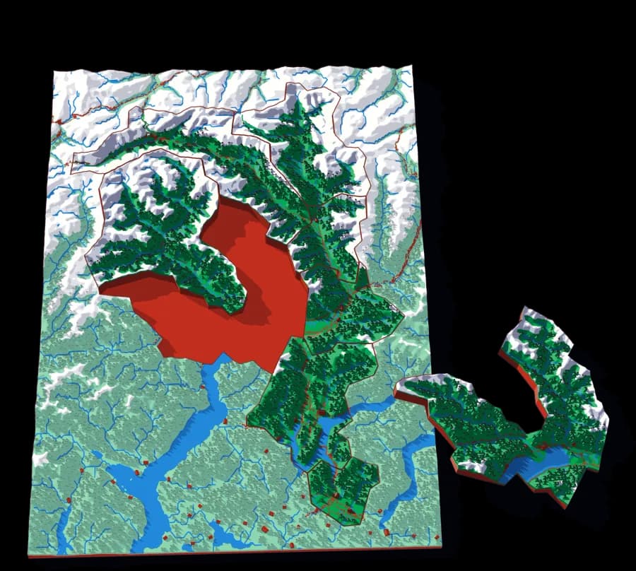
Ticino
Eight districts on the sunny side of the Alps
Bellinzona, Locarno, Lugano, Mendrisio, Blenio, Leventina, Riviera, Vallemaggia — eight pieces, all mountain.
- Pieces
- 8 pieces
- Scale
- 1 mm ≈ 387 m
- Suitable for
- Ages 6 and up
- Price
- CHF 15.00
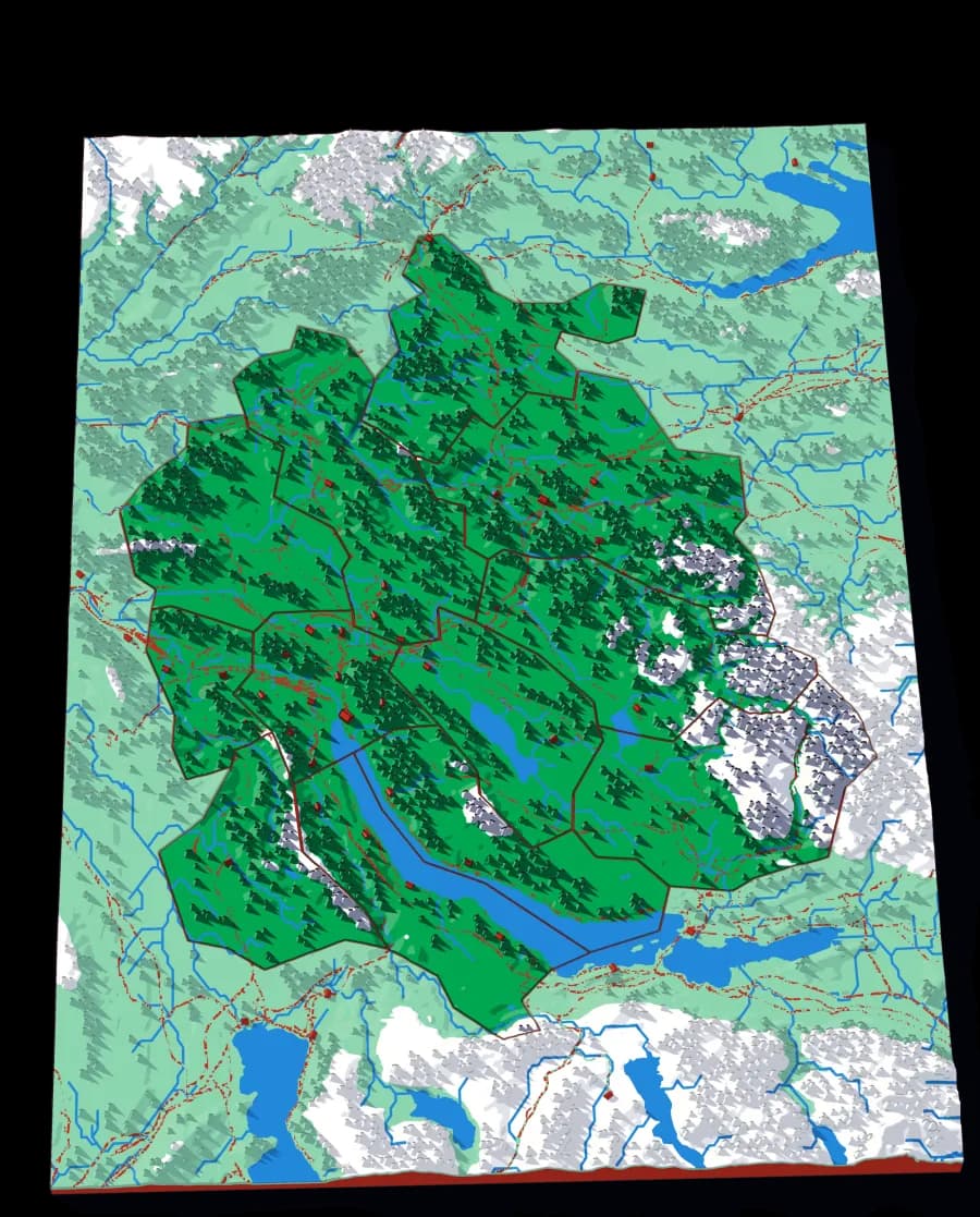
Canton Zürich
Twelve districts around the lake
The whole canton at 305 metres to the millimetre, with the lake, the Glatt valley and the Albis ridge.
- Pieces
- 12 pieces
- Scale
- 1 mm ≈ 305 m
- Suitable for
- Ages 6 and up
- Price
- CHF 15.00
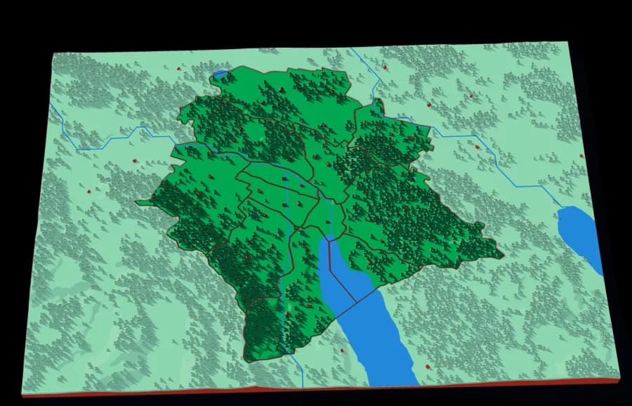
Zürich City
The twelve Kreise
The city districts at 81 metres to the millimetre — the finest scale in the collection.
- Pieces
- 12 pieces
- Scale
- 1 mm ≈ 81 m
- Suitable for
- Ages 7 and up
- Price
- CHF 15.00
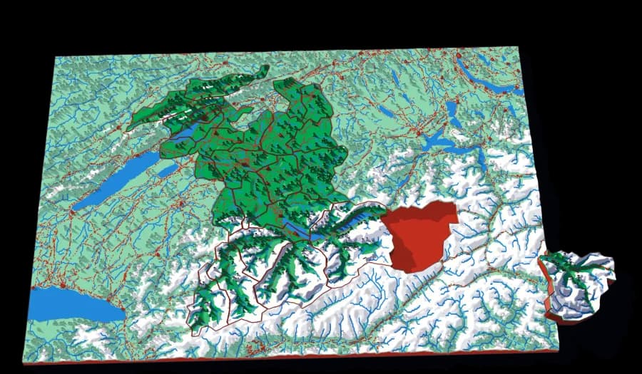
Canton Bern
Twenty-six districts, Jura to Jungfrau
The largest cantonal spread in the collection — from the folded Jura in the northwest to the high Bernese Alps.
- Pieces
- 26 pieces
- Scale
- 1 mm ≈ 724 m
- Suitable for
- Ages 7 and up
- Price
- CHF 15.00
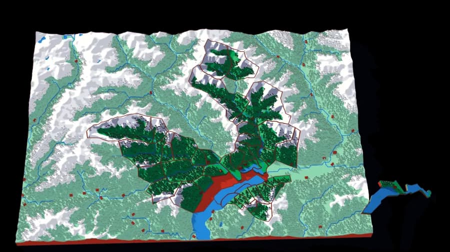
Locarno
Forty comuni above Lake Maggiore
Village-scale, at 233 metres to the millimetre: Ascona, Brissago, Corippo, the whole Verzasca.
- Pieces
- 36 pieces
- Scale
- 1 mm ≈ 233 m
- Suitable for
- Ages 9 and up
- Price
- CHF 15.00
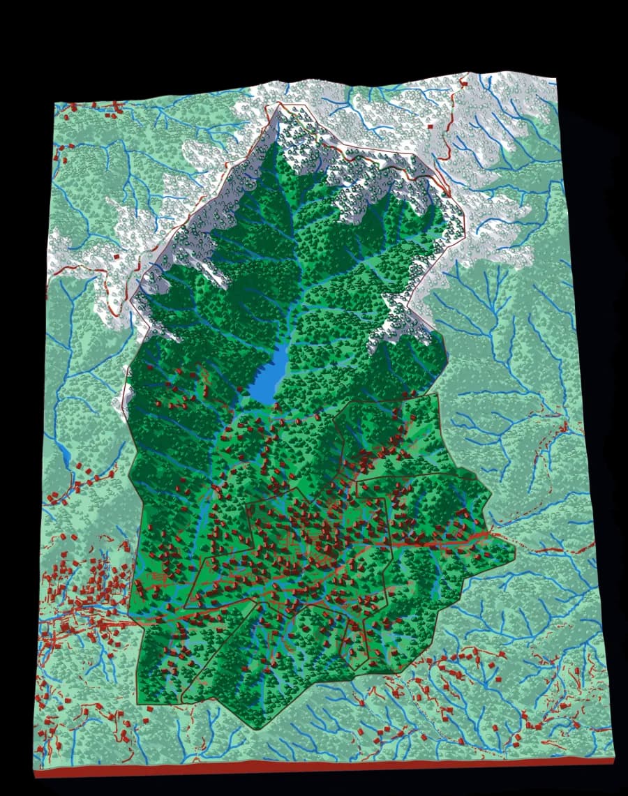
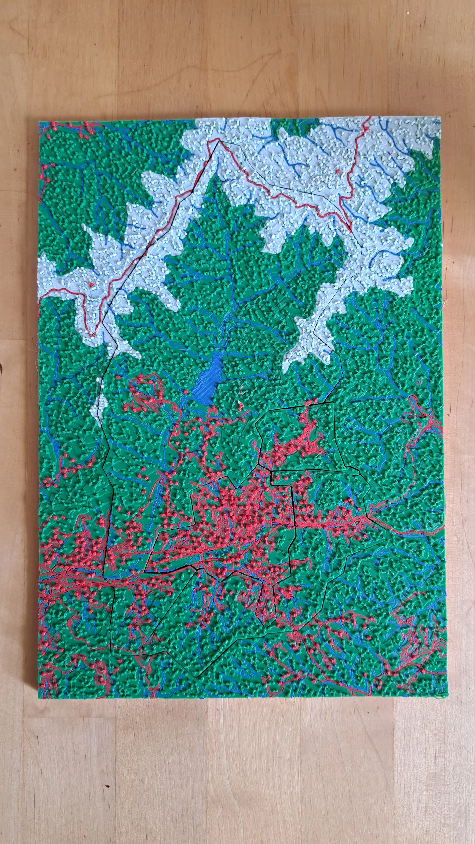
Black Mountain
Four towns in one Appalachian valley
Four pieces at 87 metres to the millimetre. Small, simple, and very local.
- Pieces
- 4 pieces
- Scale
- 1 mm ≈ 87 m
- Suitable for
- Ages 4 and up
- Price
- CHF 15.00
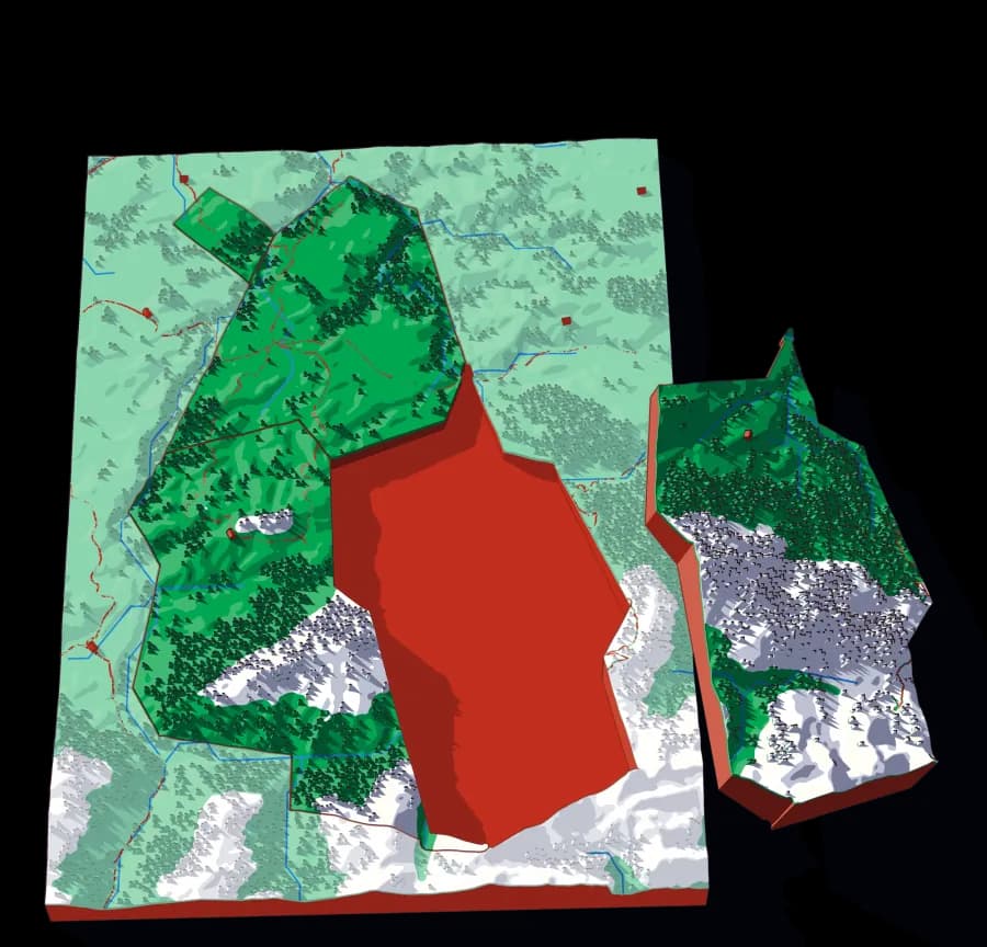
Schwarzenburg
Four communes in the Bernese pre-Alps
Albligen, Guggisberg, Rüschegg and Wahlern at 85 metres to the millimetre.
- Pieces
- 4 pieces
- Scale
- 1 mm ≈ 85 m
- Suitable for
- Ages 4 and up
- Price
- CHF 15.00
Missing a puzzle?
A country, a valley, the river you grew up on — tell me which place you'd love as a puzzle.